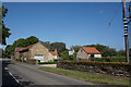
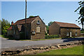
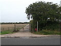
Area Overview for Cammeringham
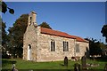
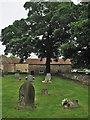
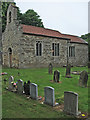
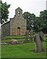
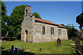
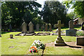
Photos of Cammeringham

Area Information
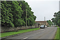
Cammeringham is a small civil parish covering an area of 7.4 km². It lies within the broader county of Norfolk, though specific district details are not provided in the available information. The landscape is free from significant planning constraints such as Areas of Outstanding Natural Beauty, protected nature reserves, or designated protected woodland. This lack of restrictions offers straightforward development potential, although current figures do not specify how much of the land is currently built upon. The area presents a low flood risk, rated with a score of 8.07 out of 100, meaning residents face minimal threat from waterlogging during heavy weather events. Daily life in Cammeringham revolves around a community where safety is a primary consideration. Crime risk assessments place the area in a warning category with a score of 62, indicating that crime rates hover around the national average. Standard security precautions are advisable for anyone moving here to ensure their property remains secure. The parish does not contain Ramsar wetland sites or other sensitive ecological designations, which simplifies planning for future changes to the local environment. While specific details on local amenities, schools, or shopping centres are absent from the current dataset, the structural layout suggests a quiet, low-density settlement. Prospective buyers should appreciate the openness of the land while remaining mindful of the average crime levels present in this specific parish. The combination of open space and standardised safety measures defines the practical reality of residing here.
- Area Type
- Parish
- Area Size
- 7.4 km²
- Population
- Not available
- Population Density
- Not available
Demographics
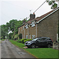
The community in Cammeringham has a distinctly mature population profile. Data indicates a median age of 70 years, suggesting that the area attracts older residents or serves as a retirement destination. The most common age range recorded is simply listed as Age: Total, confirming that a specific breakdown of younger cohorts is not highlighted in this dataset. This demographic skew likely influences local service usage, with a higher reliance on healthcare facilities and proximity to GP surgeries being essential considerations. Home ownership stands at 66 per cent, which is a significant majority compared to rental populations across the wider UK. This figure implies that a large portion of the housing stock consists of owner-occupied properties rather than buy-to-let investments or social housing blocks. Such a high rate of ownership often correlates with long-term stability and a settled community atmosphere. The data does not specify household composition types, but the age profile strongly suggests they cater primarily to singles, couples without children, or empty nesters. Accommodation types are not detailed, so one cannot definitively state whether terraced, semi-detached, or detached homes predominate. The population also lacks specific data on predominant ethnic groups or religious affiliations, meaning the area appears demographically uniform based on the available age and ownership statistics. Overall, the census profile paints a picture of a stable, older cohort who have stayed or settled in Cammeringham for the long term.
Household Size
Accommodation Type
Tenure
Ethnic Group
Religion
Household Composition
Age
Household Deprivation
NS-SEC
Explore more demographic insights in this area
Go to Demographics tabPlanning
Planning Constraints
- Flood RiskPremium
- Ramsar Wetland SitesPremium
- Area of Outstanding Natural BeautyPremium
- Protected Nature ReservePremium
- Protected WoodlandPremium