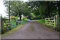
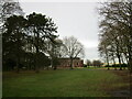
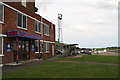
Area Overview for Byard's Leap
Photos of Byard's Leap


Area Information
Living in Byard's Leap offers a specific type of settlement experience within England. This built-up area spans approximately 79.0 hectares, positioning it as a distinct town or city entity rather than a sprawling suburban extension. You are entering a space defined by its physical boundaries, encompassing a total land mass that supports its residential character. The area functions as a cohesive community where daily life revolves around local infrastructure and proximity to transport nodes. Residents navigate a defined landscape that separates them from the wider county, creating a clear sense of place. Your daily routine here involves interacting with neighbours within this 79-hectare footprint while maintaining access to surrounding services. The designation as a built-up area suggests a degree of urban density, though the specific reasons for these boundaries often remain rooted in historical planning decisions. You will find a community where identity is tied to this specific plot of land, distinct from neighbouring villages or larger urban centres. The constraints of size mean that opportunities are concentrated, requiring you to make do with what is immediately available. This compact nature can foster a tight-knit environment where everyone knows their place within the locality. When you consider placing a homebase here, you accept a lifestyle defined by these tangible geographic limits. The area does not offer the expansive sprawl of larger cities, instead providing a contained environment for domestic life. Your experience of Byard's Leap will be shaped heavily by these physical dimensions and the community built within them.
- Area Type
- Built Up Area 250
- Area Size
- 79.0 hectares
- Population
- Not available
- Population Density
- Not available
Daily life in Byard's Leap is anchored by a network of practical amenities within practical reach. You will find a robust selection of retail outlets, including a Co-op Ancaster, a Spar, and a Lincolnshire Co-operative Co option. These five retail locations ensure you can purchase groceries and essentials without extensive travel. The presence of these specific brands guarantees familiarity and standardised quality for your weekly shopping haul. For commuters, rail connectivity is a defining feature of the local lifestyle. Four railway stations lie close by, including Ancaster Railway Station, Rauceby Railway Station, and Sleaford Railway Station. These nodes offer direct links to wider transport networks, reducing the need for private vehicle reliance during peak hours. Your routine might involve stepping onto a train at one of these stations to reach Sleaford or beyond. Aviation options are also notable, with two airports nearby: RAF Cranwell and RAF Barkston Heath. While these facilities primarily serve military and training functions, their presence adds a layer of regional significance. You benefit from a transport-rich environment that combines road, rail, and air infrastructure. Living in Byard's Leap means you have immediate access to goods and transit hubs without crossing significant geographic barriers. The five remaining retail sites complement the railways, creating a self-sustaining loop for daily needs.
Amenities
Schools
| Rank | School | Type | Entry gender | Ages |
|---|
Explore more schools in this area
Go to Schools tabDemographics
The community in Byard's Leap displays a clear demographic profile defined by age and ownership patterns. A median age of 70 indicates that the population centres on older adults, suggesting a significant demographic shift away from younger families. This age distribution points towards a retirement-focused zone where residents have likely downsized or settled for quiet years. You are entering an area dominated by Seniors United Age rather than young professionals or growing households. The home ownership rate stands at 69%, meaning nearly seven out of ten residents own their property outright or with a mortgage. This high percentage reflects a long-term resident base that has stayed through various life stages. Most common age ranges break down such that the total population aggregates heavily into the older brackets. The household composition data shows a total count that aligns with these senior demographics, implying many single-person or couple-only homes. Accommodation types generally mirror these ownership trends, with a predominance of detached or semi-detached properties suitable for mature households. You will find a level of stability within the social fabric, driven by individuals who have invested deeply in their local presence. The demographic make-up suggests a quiet, low-energy social scene centred on leisure rather than work commuting. Understanding these figures helps you picture daily interactions and community events tailored to an older demographic. The 69% ownership figure is a concrete indicator of financial commitment to this specific locality. Consequently, rental units are less common than in larger urban centres. The prevailing diversity metrics indicate a total population without specific breakdowns for ethnic groups, focusing instead on the age composition.
Household Size
Accommodation Type
Tenure
Ethnic Group
Religion
Household Composition
Age
Household Deprivation
NS-SEC
Explore more demographic insights in this area
Go to Demographics tabPlanning
Planning Constraints
- Crime RiskPremium