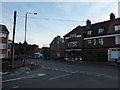
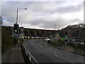
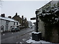
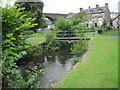
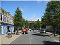
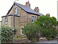
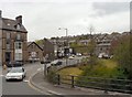
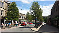
Area Overview for Buxton Central Ward
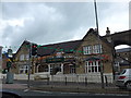
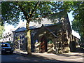
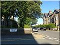
Photos of Buxton Central Ward

Area Information
Living in Buxton Central Ward offers a distinct residential experience within the borough of Buxton. This district covers an area of 82.7 hectares, providing a compact yet significant living space for its residents. The neighbourhood functions as a core district unit, situated within the wider unitary authority. You will find that daily life here is defined by a intimate scale, where the boundaries of the ward are clearly marked by its specific administrative designation. The area serves as a central node for the local borough, concentrating residents within a manageable footprint. People choose this location for its established character and its position within the broader Buxton framework. The ward represents a settled community that balances urban convenience with a defined geographical limit. You can expect a straightforward neighbourhood dynamic where the 82.7 hectares shape the daily rhythm of life. This is not a sprawling zone but a targeted district where services and homes cluster together. The identity of Buxton Central Ward remains firmly tied to its role as a primary ward within the borough structure. Residents here benefit from a clear sense of place, anchored by the ward's specific size and administrative status. It is a practical choice for those seeking a defined community with clear boundaries and a strong local identity. The community profile of Buxton Central Ward is heavily weighted towards older adults. Median age reaches 70 years, making this the oldest median age recorded for the ward in comparison to other districts. The most common age range aligns with this high median, indicating a population dominated by those in their later years. Only 51% of households own their homes, a figure lower than the national average for similar commuter towns. This statistic implies that a significant portion of the population consists of private renters or those purchasing with less equity. Household composition reflects an ageing demographic, with few younger families entering the market. Accommodation types in the ward generally suit single occupants or couples, rather than large families. The ethnic makeup follows the predominant national patterns found across the wider borough, showing limited diversity. Religious affiliation mirrors the broader county trends, with traditional church attendance likely forming the baseline. There is no special deprivation data highlighted separately, meaning residents generally access standard local services without marked disadvantage. Safety scores for property crime sit at 35 out of 100, which is around the average for the country. This rating suggests you should apply standard security precautions but does not indicate a crisis. The area offers stability for those accustomed to an older demographic but may lack vibrant youth energy. Buxton Central Ward presents a housing landscape where owner occupation is below the typical benchmark. With 51% of households owning their homes, more than half of the residents are tenants. This trend suggests a significant rental market exists within the ward, likely catering to retiring professionals or younger workers seeking rent-to-own opportunities. The accommodation stock probably includes affordable housing options, given the lower ownership rate compared to similar wealthier areas. Buyers looking for equity security might find this a challenging environment unless they commit to buying existing freehold properties. The 82.7 hectares of land contain a mix of housing likely suitable for singles or small families rather than large mortgages. You should expect to see a higher proportion of rented units than you would in a typical estate suburb. This dynamic affects mortgage lending and local investment potential. The prevalence of renting indicates that the local economy may not support high house prices or aggressive private sector development. Potential buyers must research individual street prices carefully, as the market does not naturally push ownership rates up. Conversely, landlords may find a steady demand from residents who prefer the flexibility of renting while living in this 82.7 hectare zone. Digital infrastructure in Buxton Central Ward provides a solid foundation for modern living and remote work. Fixed broadband quality scores an 82 out of 100, placing it in the good to excellent range. This performance level ensures reliable speeds for streaming, video conferencing, and large file transfers. Residents can expect consistent internet stability without the frequent disruptions found in lower-scoring rural zones. A score of 82 describes a robust connection that meets the needs of heavy users and remote employees. You do not need to worry about bandwidth struggling during peak evening hours or under heavy download loads. The connectivity supports a functional work-from-home lifestyle, making the ward viable for commuters удалёnd employment. Mobile coverage in the ward maintains standard urban reliability across the 82.7 hectares. The digital environment is fully capable of supporting smart home devices and high-definition entertainment. High-speed internet access removes a common barrier for families considering a move to this district. You can rely on your online tools remaining operational throughout the day. The broadband standard is a practical asset that enhances the overall living experience in Buxton Central Ward. Safety and environmental factors in Buxton Central Ward require practical consideration from prospective residents. The crime risk assessment yields a score of 35 out of 100, which falls into the warning category. This rating indicates a medium crime risk, meaning rates are around the national average. You should apply standard security precautions such as locking doors and using reliable lighting at night. The flood risk presents a more notable concern with a score of 13.27 out of 100. This low score signals medium flood risk coverage, so properties may face occasional water saturation during heavy rainfall. Planning constraints include protected woodland, which carries a warning status. This landscape feature adds value environmentally but limits certain types of development. The area passes checks for Ramsar wetland sites and Areas of Outstanding Natural Beauty, removing major planning hurdles. However, the presence of protected woodlands means trees and vegetation cannot easily be removed anywhere on the land. These environmental protections ensure the greenery remains intact for local residents. While the crime rate is average, the flood risk remains the primary safety factor to weigh. What is the typical age of people living in Buxton Central Ward?The community is notably older, with a median age of 70 years. Most common age groups align with this figure reflect an ageing population. Comparisons with other districts show this ward has the highest senior demographic concentration. How reliable is the internet connection for working from home?Fixed broadband quality scores an 82 out of 100, which ranks as good. This performance level supports reliable speeds for remote work, streaming, and digital entertainment without significant interruption. Is the crime rate in Buxton Central Ward higher or lower than average?The crime risk score sits at 35 out of 100, placing it in the warning category for medium risk. Crime rates are around the national average, meaning standard security precautions are advisable for all residents. Are there any environmental risks I should know about before buying?The area carries a warning for flood risk with a score of 13.27 out of 100. This indicates medium flood risk coverage, so you should assess individual property vulnerability before completing a purchase.
- Area Type
- District Borough Unitary Ward
- Area Size
- 82.7 hectares
- Population
- Not available
- Population Density
- Not available
Demographics
The community profile of Buxton Central Ward is heavily weighted towards older adults. Median age reaches 70 years, making this the oldest median age recorded for the ward in comparison to other districts. The most common age range aligns with this high median, indicating a population dominated by those in their later years. Only 51% of households own their homes, a figure lower than the national average for similar commuter towns. This statistic implies that a significant portion of the population consists of private renters or those purchasing with less equity. Household composition reflects an ageing demographic, with few younger families entering the market. Accommodation types in the ward generally suit single occupants or couples, rather than large families. The ethnic makeup follows the predominant national patterns found across the wider borough, showing limited diversity. Religious affiliation mirrors the broader county trends, with traditional church attendance likely forming the baseline. There is no special deprivation data highlighted separately, meaning residents generally access standard local services without marked disadvantage. Safety scores for property crime sit at 35 out of 100, which is around the average for the country. This rating suggests you should apply standard security precautions but does not indicate a crisis. The area offers stability for those accustomed to an older demographic but may lack vibrant youth energy. Buxton Central Ward presents a housing landscape where owner occupation is below the typical benchmark. With 51% of households owning their homes, more than half of the residents are tenants. This trend suggests a significant rental market exists within the ward, likely catering to retiring professionals or younger workers seeking rent-to-own opportunities. The accommodation stock probably includes affordable housing options, given the lower ownership rate compared to similar wealthier areas. Buyers looking for equity security might find this a challenging environment unless they commit to buying existing freehold properties. The 82.7 hectares of land contain a mix of housing likely suitable for singles or small families rather than large mortgages. You should expect to see a higher proportion of rented units than you would in a typical estate suburb. This dynamic affects mortgage lending and local investment potential. The prevalence of renting indicates that the local economy may not support high house prices or aggressive private sector development. Potential buyers must research individual street prices carefully, as the market does not naturally push ownership rates up. Conversely, landlords may find a steady demand from residents who prefer the flexibility of renting while living in this 82.7 hectare zone. Digital infrastructure in Buxton Central Ward provides a solid foundation for modern living and remote work. Fixed broadband quality scores an 82 out of 100, placing it in the good to excellent range. This performance level ensures reliable speeds for streaming, video conferencing, and large file transfers. Residents can expect consistent internet stability without the frequent disruptions found in lower-scoring rural zones. A score of 82 describes a robust connection that meets the needs of heavy users and remote employees. You do not need to worry about bandwidth struggling during peak evening hours or under heavy download loads. The connectivity supports a functional work-from-home lifestyle, making the ward viable for commuters удалёnd employment. Mobile coverage in the ward maintains standard urban reliability across the 82.7 hectares. The digital environment is fully capable of supporting smart home devices and high-definition entertainment. High-speed internet access removes a common barrier for families considering a move to this district. You can rely on your online tools remaining operational throughout the day. The broadband standard is a practical asset that enhances the overall living experience in Buxton Central Ward. Safety and environmental factors in Buxton Central Ward require practical consideration from prospective residents. The crime risk assessment yields a score of 35 out of 100, which falls into the warning category. This rating indicates a medium crime risk, meaning rates are around the national average. You should apply standard security precautions such as locking doors and using reliable lighting at night. The flood risk presents a more notable concern with a score of 13.27 out of 100. This low score signals medium flood risk coverage, so properties may face occasional water saturation during heavy rainfall. Planning constraints include protected woodland, which carries a warning status. This landscape feature adds value environmentally but limits certain types of development. The area passes checks for Ramsar wetland sites and Areas of Outstanding Natural Beauty, removing major planning hurdles. However, the presence of protected woodlands means trees and vegetation cannot easily be removed anywhere on the land. These environmental protections ensure the greenery remains intact for local residents. While the crime rate is average, the flood risk remains the primary safety factor to weigh. What is the typical age of people living in Buxton Central Ward?The community is notably older, with a median age of 70 years. Most common age groups align with this figure reflect an ageing population. Comparisons with other districts show this ward has the highest senior demographic concentration. How reliable is the internet connection for working from home?Fixed broadband quality scores an 82 out of 100, which ranks as good. This performance level supports reliable speeds for remote work, streaming, and digital entertainment without significant interruption. Is the crime rate in Buxton Central Ward higher or lower than average?The crime risk score sits at 35 out of 100, placing it in the warning category for medium risk. Crime rates are around the national average, meaning standard security precautions are advisable for all residents. Are there any environmental risks I should know about before buying?The area carries a warning for flood risk with a score of 13.27 out of 100. This indicates medium flood risk coverage, so you should assess individual property vulnerability before completing a purchase.
Household Size
Accommodation Type
Tenure
Ethnic Group
Religion
Household Composition
Age
Household Deprivation
NS-SEC
Explore more demographic insights in this area
Go to Demographics tabPlanning
Planning Constraints
- Flood RiskPremium
- Ramsar Wetland SitesPremium
- Area of Outstanding Natural BeautyPremium
- Protected Nature ReservePremium
- Protected WoodlandPremium
- Crime RiskPremium