Area Overview for Burton on the Wolds
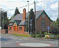
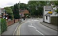
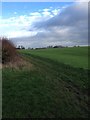
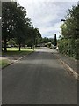
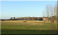
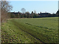
Photos of Burton on the Wolds

Area Information
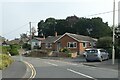
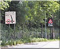
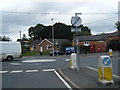
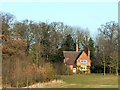
Burton on the Wolds is a built-up area covering 1.2 square kilometres, situated in England. It functions as a defined town rather than a sprawling city, offering a compact environment where daily life requires minimal travel for most essentials. The small footprint means that residents often know their neighbours and that the setting remains intimate despite its classification as a built-up zone. Living in Burton on the Wolds provides a grounded experience where the physical boundaries of the town are easy to navigate. You can walk to the local Co-op Barrow or Spar stores without needing a car, as these amenities are within practical reach. The area maintains a clear identity distinct from larger metropolitan centres, focusing on a simpler rhythm of life. This locality serves as a specific hub for those seeking a contained community presence. The concentration of services within 1.2 square kilometres reflects a deliberate design that prioritises accessibility. Whether you are looking at homes in Burton on the Wolds for retirement or a quiet family life, the scale of the town supports these needs directly. The settlement does not attempt to compete with major cities for luxury or extensive shopping options. Instead, it offers a traditional layout where the high rate of homeownership suggests long-term stability. Your daily routine centres around walking distances to key locations like the primary school or railway connections in nearby Loughborough.
- Area Type
- Built Up Area 250
- Area Size
- 1.2 km²
- Population
- Not available
- Population Density
- Not available
The lifestyle in Burton on the Wolds centres on convenient, local access to essential amenities. Five retail outlets are located within easy reach, specifically Co-op Barrow, Co-op East, and Spar. These stores provide food groceries and daily necessities without requiring a journey to a larger town. You can stock your kitchen and grab snacks by walking to these specific Co-op and Spar locations. The concentration of these three retailers ensures that errands take minimal time, supporting a low-stress daily routine. Beyond shopping, transport links integrate seamlessly into daily life. Three rail stations—Loughborough Railway Station, Barrow upon Soar Railway Station, and Sileby Railway Station—are listed as nearby options. These stations facilitate trips beyond the immediate 1.2 square kilometre boundary. You can combine the convenience of local Co-op stores with the connectivity of the rail network for a balanced week. Leisure options appear to be less extensive than the retail and transport infrastructure, focusing primarily on the practical aspects of living. This approach offers a quiet existence for those who value utility over nightlife or sprawling entertainment venues. The presence of Co-op Barrow and Spar means you have self-sufficiency built into your address. You do not need to drive to the outskirts of the county for basic shopping. The nearby rail stations at Loughborough and Barrow upon Soar allow quick excursions when you need to break the routine. Living in this setting means your world extends a short distance from your doorstep, governed by the reach of these specific shops and train lines.
Amenities
Schools
The educational landscape for families near Burton on the Wolds is straightforward, supported by one listed institution. You will find Burton-on-the-Wolds Primary School within the vicinity, which operates as a primary school. This school holds an Ofsted rating of outstanding, a designation that signals high standards in teaching, leadership, and student outcomes. For parents considering schools near Burton on the Wolds, this rating provides a definitive marker of quality without the need for further scrutiny of local options. Because this is the only school listed in the immediate data, secondary education requires travel to larger centres. The presence of a primary school with an outstanding rating is a significant asset for local families, ensuring children receive a strong foundation in reading, writing, and mathematics. The mix of school types here is limited to primary education, meaning secondary education is not conducted within the town boundaries. Families with young children will benefit from the proximity of this highly rated primary institution. This singular focus on one primary school shapes the demographic profile of families living in Burton on the Wolds. It acts as an anchor for families with primary school-aged children, likely keeping younger demographics in the area longer than expected given the high median age. The outstanding status of Burton-on-the-Wolds Primary School means that when you check home sales data, you may see price premiums associated with properties offering a short walk to this school. Buyers do not need to look further for primary options, as this facility meets the highest regulatory standards in the education sector.
| Rank | School | Type | Entry gender | Ages |
|---|
Explore more schools in this area
Go to Schools tabDemographics
The community in Burton on the Wolds presents a very specific age profile, with a median age of 70 years. This figure indicates that the town is dominated by older adults, suggesting it is a retirement destination or a place where many families move when children have left home. The most common age bracket encompasses the total population, confirming that the demographic skew is significant. You should expect a neighbourhood where independence is valued and community interaction likely centres around leisure activities rather than raising young families. Home ownership stands at 86%, which is exceptionally high compared to the national average. This statistic reveals that the vast majority of households own their properties outright or have a substantial mortgage. Such a figure points to an ageing population that has spent decades building equity and downsizing into the current housing stock. There is little evidence of a large private rental sector, meaning you will mostly interact with owner-occupiers who are settled in their homes. The accommodation type data reflects this stability, showing a mix of properties suited to later-life living. Diversity metrics indicate that residents primarily belong to the total ethnic group, meaning the population is largely White British. Religious affiliation data aligns with this demographic, showing a predominantly Christian population consistent with the area's history. Deprivation levels are low, correlating with the high safety scores and the predominant ownership of homes. You do not need to worry about poverty-driven crime or inadequate housing stock, as the 86% ownership rate suggests financial security among residents. Life here is shaped by a retired or semi-retired crowd who have achieved a stable economic position within their households.
Household Size
Accommodation Type
Tenure
Ethnic Group
Religion
Household Composition
Age
Household Deprivation
NS-SEC
Explore more demographic insights in this area
Go to Demographics tabPlanning
Planning Constraints
- Crime RiskPremium