Area Overview for Burton Latimer
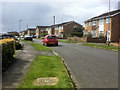
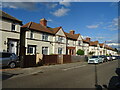
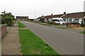
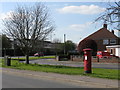
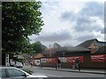
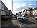
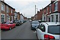
Photos of Burton Latimer


Area Information
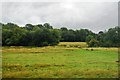
Burton Latimer stands as a established built-up area within England, covering a total size of 2.7 square kilometres. This compact footprint defines the character of the locality, creating a neighbourhood where daily life centres around a tightly knit community. You will find a residential environment that has developed significantly over time, resulting in a population with a distinct demographic profile. The area is situated to offer convenient access to wider networks while maintaining a local identity. For anyone considering homes in Burton Latimer, the location represents a settled community with clear boundaries and a defined perimeter. The built-up nature of the area ensures that amenities are generally within walking or short driving distance. Residents enjoy a setting that balances local convenience with proximity to regional hubs. Living in Burton Latimer means choosing a location where the scale of the environment matches the lifestyle of long-term residents. The area provides a stable setting for families and individuals seeking a home in the countryside fringe of the borough.
- Area Type
- Built Up Area 250
- Area Size
- 2.7 km²
- Population
- Not available
- Population Density
- Not available
Residents of Burton Latimer benefit from a range of amenities within practical reach of their homes. Five retail outlets serve the local shopping needs, including Sainsburys Burton, Budgens Barton, and Aldi Pytchley. These supermarkets provide essential groceries and daily necessities without requiring long journeys into the city centre. Transport links are well developed, with two railway stations available for commuters. You can travel to Kettering Railway Station or Wellingborough Railway Station to access wider rail networks. A bus interchange serves the area, offering one integrated transport hub for local and regional connections. This amenity count ensures that daily shopping and commuting do not consume excessive time. The presence of these named venues like Sainsburys Burton and Budgens Barton anchors the local high street experience. You can rely on these facilities to meet routine household requirements efficiently.
Amenities
Schools
Families living in Burton Latimer have access to four primary schools listed in the immediate vicinity. Meadowside Junior School serves as a key educational institution for younger children in the community. Meadowside Primary School holds a 'good' Ofsted rating, providing a verified standard of education for its pupils. St Mary's Church of England Primary School, Burton Latimer, offers religious education within a traditional framework. St Mary's CofE Primary Academy, Burton Latimer, operates as an academy within the same trust or community network. St. Marys CofE Primary School also carries a 'good' Ofsted rating, confirming consistent quality across multiple local institutions. This mix of primary schools means you have several options depending on your specific educational preferences or religious requirements. The presence of rated academies and church schools provides a structured choice for parents shopping for homes near these facilities. Each school serves the local catchment areas, ensuring that residents have multiple nearby choices for their children's education.
| Rank | School | Type | Entry gender | Ages |
|---|
Explore more schools in this area
Go to Schools tabDemographics
The community in Burton Latimer reflects a mature population, with a median age of 70 years. This figure indicates that the area is populated largely by older residents who have settled here for an extended period. The household composition data confirms a stable social structure across the total population of the locality. Home ownership stands at a high level, with 75 per cent of homes owned by their occupants. This statistic suggests a community where the majority of families have remained in their residences for generations. The total accommodation type breakdown shows a consistent housing stock designed for permanent living. While specific ethnic group data and religious affiliations are aggregated as totals, the dominant trend points to a traditional, settled population. This demographic profile creates a quiet, respectful atmosphere where changes move slowly. For you as a potential buyer, this means entering a environment where local customs and routines are well established. The high ownership percentage also implies a market where properties often stay with the same family for decades.
Household Size
Accommodation Type
Tenure
Ethnic Group
Religion
Household Composition
Age
Household Deprivation
NS-SEC
Explore more demographic insights in this area
Go to Demographics tabPlanning
Planning Constraints
- Crime RiskPremium