Area Overview for Burnaston
Photos of Burnaston
Area Information
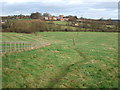
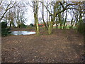
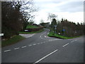
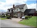
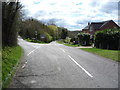
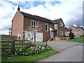
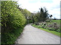
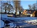
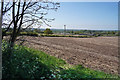
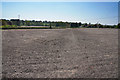
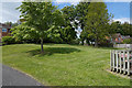
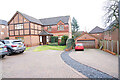
Burnaston remains a distinct civil parish within South Derbyshire, situated approximately 4.5 miles southwest of Derby. The area covers 7.1 km² of largely rural terrain that balances village tranquillity with proximity to major conurbations. Historically named Bernulfestun in the Domesday Book, the settlement evolved from an early Saxon farm into a community with its own parish structures. Today, Burnaston functions as a quiet residential hub while retaining links to its industrial past. The former Derby Airport site nearby now hosts Toyota Manufacturing UK, creating a local economy driven by vehicle production. This shift means the village sits at an interesting intersection between traditional rural life and modern commuter convenience. Residents benefit from direct road access via the A38 dual carriageway, which connects the parish to Nottingham and Birmingham around 40 miles away. The village hall, originally a 19th-century mission room, serves as a central meeting point for local events. As you explore homes in Burnaston, you will find a mix of historic farms, older cottages, and newer developments built on former hospital grounds. This evolution creates a layered character where modern apartments like those at Jewsbury Court sit alongside centuries-old masonry. Each home tells a story, whether it is a property with Roman finds from nearby excavations or a contemporary flat with river views. The area offers a practical compromise for those who value countryside living without needing to travel far into Derby city centre.
- Area Type
- Parish
- Area Size
- 7.1 km²
- Population
- Not available
- Population Density
- Not available
Demographics
The community profile of Burnaston reflects a mature population concentrated in independent living rather than family households. Census data indicates a median age of 70, signalling a neighbourhood where retirees hold the highest percentage of residents. This age structure naturally influences local needs and community dynamics, as the area caters largely to older demographics seeking quiet surroundings. Home ownership stands at a high 81%, showing that most people in Burnaston have secured their properties and built long-term roots. This high retention rate suggests stability, with fewer transient workers reshaping the street scene on a yearly basis. The area also features a post-code of DE65, which distinguishes it from other regions of the East Midlands. While specific breakdowns regarding ethnicity or religious affiliation are not detailed in the provided records, the overall demographic weight leans heavily towards the over-sixties bracket. This composition means you, as a potential buyer, are entering a market dominated by established families or couples down-sizing after family life. Large multi-generational homes remain, though many have been subdivided into purpose-built flats to accommodate changing family sizes. The absence of significant younger cohorts shapes the local schools and retail offerings accordingly. You should expect a slower pace of life where neighbours know each other by name and community gardens dominate the local landscape. The population estimates have grown recently, reaching approximately 2,887 residents, yet the village retains its small-town footprint.
Household Size
Accommodation Type
Tenure
Ethnic Group
Religion
Household Composition
Age
Household Deprivation
NS-SEC
Explore more demographic insights in this area
Go to Demographics tabPlanning
Planning Constraints
- Flood RiskPremium
- Ramsar Wetland SitesPremium
- Area of Outstanding Natural BeautyPremium
- Protected Nature ReservePremium
- Protected WoodlandPremium
- Crime RiskPremium