Area Overview for Burbage St. Catherines and Lash Hill Ward
Photos of Burbage St. Catherines and Lash Hill Ward

Area Information
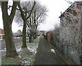
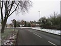
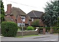
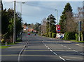
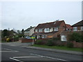
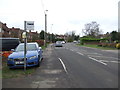
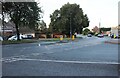
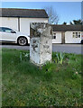
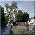
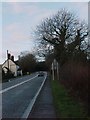
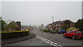
Living in Burbage St. Catherines and Lash Hill Ward offers a distinctly rural experience just miles from the industrial town of Hinckley. This three kilometre square ward within the parish of Burbage feels like a separate village, largely because a ribbon of railway land physically separates it from the urban sprawl of Hinckley. The area sits at approximately 130 metres above sea level on a flat plain, creating an open landscape that prioritises the countryside despite its proximity to major transport arteries. You can access the M69 motorway and the A5 within a mile, providing a strategic link between Leicestershire, Warwickshire, and the West Midlands. These routes would have served cottage industries centuries ago but now function as primary arteries for commuters working further afield. The local economy historically relied on the manufacture of stockings and hosiery before transitioning to a commuter location. Historical density likely peaked during the 19th and 20th centuries following mechanisation, though current figures show a stable, mature community. The ward retains a rural character despite being effectively engulfed by northern Leicestershire, making it a quiet retreat for families who value immediate access to the West Midlands while maintaining a village lifestyle. The designated conservation area protects historic buildings, ensuring the visual identity of the village centre remains intact for residents and visitors alike.
- Area Type
- District Borough Unitary Ward
- Area Size
- 3.4 km²
- Population
- Not available
- Population Density
- Not available
Demographics
The community profile of Burbage St. Catherines and Lash Hill Ward is defined by an exceptionally mature population. Data indicates a median age of 70, which is significantly higher than the national average for England. This suggests the area is populated largely by older residents, possibly retirees who have moved to the hedgeless, flat landscape away from city noise. The ward comprises only one age range category in the provided data, highlighting a lack of young families or working-age adults as the primary demographic drivers. A strong sense of stability exists here, evidenced by a home ownership level of 69%. This figure confirms that most residents have purchased their homes, creating a settled environment rather than a transient rental market. With such a high proportion of owner-occupied homes, leasehold disputes are less likely to dominate local issues compared to rental-heavy areas. The accommodation type data covers the total population but does not break down specific building styles, though the history of knitting frames and factories suggests a mix of older cottages and converted industrial buildings. The ward represents a quiet chapter in Leicestershire's demographics, where long-term stability outweighs rapid turnover. Living in this ward means accepting a static demographic profile where 70-year-olds and up form the core of society. This demographic reality shapes local demand for services, likely focusing on health, quiet parks, and proximity to shops rather than nightlife or primary schools.
Household Size
Accommodation Type
Tenure
Ethnic Group
Religion
Household Composition
Age
Household Deprivation
NS-SEC
Explore more demographic insights in this area
Go to Demographics tabPlanning
Planning Constraints
- Flood RiskPremium
- Ramsar Wetland SitesPremium
- Area of Outstanding Natural BeautyPremium
- Protected Nature ReservePremium
- Protected WoodlandPremium
- Crime RiskPremium