Area Overview for Bulwell Forest Ward
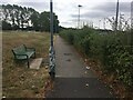
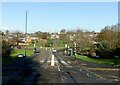
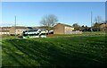
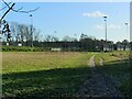
Photos of Bulwell Forest Ward
Area Information
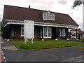
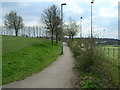
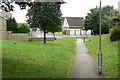
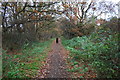
Bulwell Forest Ward sits approximately 3.5 miles southwest of Nottingham city centre within the City of Nottingham district. This electoral ward covers an area of 3.3 square kilometres and forms part of the broader Bulwell region. You will find the area defined by established suburban residential estates, including Highbury Vale, which integrate alongside remnants of ancient woodland. The ward's history traces back to the medieval period, featuring sites like Bulwell Wood, which was once a detached parcel of Sherwood Forest mentioned in records from the thirteenth century. Local landmarks include two Grade II listed buildings recorded in the National Heritage List for England. While modern housing developments from the 1960s and 1970s replaced some of the original forest, nature reserves such as Sellers Wood and a neglected remnant of Snape Wood remain nearby. Living in Bulwell Forest Ward means inhabiting a space where urban convenience meets pockets of historic greenery. The area is situated around coordinates 53.0035° N, -1.1810° W, offering a specific slice of suburban life within Nottinghamshire.
- Area Type
- District Borough Unitary Ward
- Area Size
- 3.3 km²
- Population
- 3005
- Population Density
- 905 people/km²
Demographics
The community in Bulwell Forest Ward is distinctively mature, with a median age of 70 years old. The area does not show a specific most common age range other than the total population figure, suggesting a broad spread of older residents. You will find that 68 per cent of households own their homes outright or with a mortgage. The ward has a total population of 3,005 people, indicating a relatively small community density. With a population density of 905 people per square kilometre, the neighbourhood is neither overwhelmingly crowded nor completely sparse. Data on the predominant ethnic group, religious composition, and specific household breakdowns such as singles or families are not included in the provided records. Consequently, you cannot determine the precise diversity or family structure beyond the total figures available. The demographic profile points toward an area favoured by older settlers, perhaps those seeking retirement or quieter living arrangements. There is no data to suggest significant recent migration or youth influx, reinforcing the static nature of the age profile.
Household Size
Accommodation Type
Tenure
Ethnic Group
Religion
Household Composition
Age
Household Deprivation
NS-SEC
Explore more demographic insights in this area
Go to Demographics tabPlanning
Planning Constraints
- Flood RiskPremium
- Ramsar Wetland SitesPremium
- Area of Outstanding Natural BeautyPremium
- Protected Nature ReservePremium
- Protected WoodlandPremium
- Crime RiskPremium