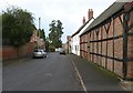
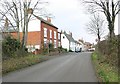
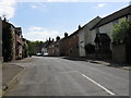
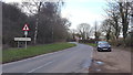
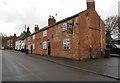
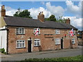
Area Overview for Bruntingthorpe
Photos of Bruntingthorpe


Area Information
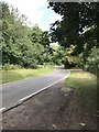
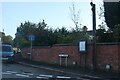
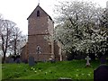
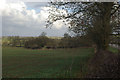
Bruntingthorpe is a village and civil parish within the Harborough district of Leicestershire, encompassing an area of 5.1 square kilometres. You will find the hamlet of Upper Bruntingthorpe within these boundaries, placing you in a very specific part of the East Midlands. This county electoral division is defined by its administrative structure and historical roots, having been recorded in the Domesday Book as lands held by Hugh de Grandmesnil. The site now includes the prominent Bruntingthorpe Aerodrome, formerly known as RAF Bruntingthorpe, which remains a notable landmark for locals and visitors alike. Daily life here revolves around a quiet, rural setting far from the rapid pace of major city centres. The grid reference SP603898 places you in a location that blends agricultural heritage with modern infrastructure. While the village name derives from Old English, meaning an outlying farm or settlement, the area retains a distinct identity today. Living in Bruntingthorpe means existing within a consecrated space that respects its history while serving current residents. You must consider the limited footprint of 5.1 square kilometres, which defines your access to open spaces and your proximity to the aerodrome. The community feels established and deep-rooted, catering primarily to those who value a connection to the land and a slower rhythm of life. There are no large town centres within the immediate village limits, so your daily needs likely rely on travel to nearby Harborough. The area is administratively stable, falling under Leicestershire County Council, which suggests consistent service delivery for core public needs. This location offers a direct link to the past while functioning as a practical residential zone in the present day.
- Area Type
- County Electoral Division
- Area Size
- 5.1 km²
- Population
- Not available
- Population Density
- Not available
Demographics
The community profile of Bruntingthorpe reveals a settlement dominated by older residents. The median age in the area is 70, which indicates that the population skews significantly towards seniors. You should expect a neighbourhood where life moves at a pace dictated by a mature demographic rather than young families or working-age professionals. The most common age range recorded is simply broad, covering the total population, but the high median figure clarifies the dominant character of the village. Home ownership is exceptionally high, standing at 84 per cent for total households. This figure confirms that Bruntingthorpe is a location where families have settled permanently rather than renting temporary accommodation. A home ownership rate of this magnitude usually reflects long-term stability and equity rather than transient renting. Consequently, the housing stock is likely filled with residents who have lived there for decades, creating a stable but potentially aged community environment. You will notice that data on household composition, accommodation types, predominant ethnic groups, and religion is not broken down in the available records. While this means specific details on diversity or family structures are not provided, the high home ownership statistic fills the picture by showing a stable, settled population. This demographic reality influences the local services, from the types of amenities available to the general atmosphere of the village. Living here means joining a community where property ownership is the norm and demographic change is likely to be gradual.
Household Size
Accommodation Type
Tenure
Ethnic Group
Religion
Household Composition
Age
Household Deprivation
NS-SEC
Explore more demographic insights in this area
Go to Demographics tabPlanning
Planning Constraints
- Flood RiskPremium
- Ramsar Wetland SitesPremium
- Area of Outstanding Natural BeautyPremium
- Protected Nature ReservePremium
- Protected WoodlandPremium
- Crime RiskPremium