Area Overview for Broughton Astley-Primethorpe & Sutton Ward
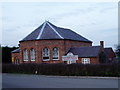
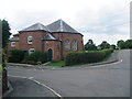
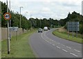
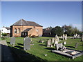
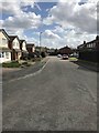
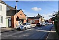
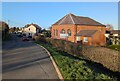
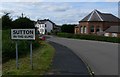
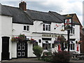
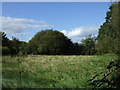
Photos of Broughton Astley-Primethorpe & Sutton Ward


Area Information
Living in the Broughton Astley-Primethorpe & Sutton Ward offers a distinct experience within the Harborough District Council area of Leicestershire. This electoral ward sits at approximately 52.5363°N, -1.2317°W, encompassing parts of the civil parish of Broughton Astley that include the Primethorpe and Sutton locations. The area covers a total size of 8.1 km², providing a compact yet spacious environment for its residents. Administrative records place the ward under Harborough 004, confirming its specific governance structure within the East Midlands region. Daily life here is shaped by this localized geography, which binds together the distinct communities of Primethorpe and Sutton under a single electoral umbrella. You find yourself in a setting where the boundaries of the civil parish dictate much of the local character. The ward represents a focused pocket of the wider English countryside, offering a contained scale that contrasts with larger urban districts. Your routine as a resident is tied to these specific coordinates, which define both the administrative and physical reality of your neighbourhood.
- Area Type
- District Borough Unitary Ward
- Area Size
- 8.1 km²
- Population
- Not available
- Population Density
- Not available
Demographics
The community in the Broughton Astley-Primethorpe & Sutton Ward is defined by a notably older population. Your most common age demographic falls into the Total Age category, which aligns with a median age of 70 years. This statistic indicates a settlement dominated by retirees or long-term residents rather than young families. Home ownership stands at 82%, reflecting a neighbourhood where the majority of households own their properties outright or through a mortgage. This high level of tenure affects the stability of the local community, as residents are less likely to move frequently. The ward exhibits a consistent profile across its total household composition and total accommodation types, suggesting a uniform residential pattern. While specific breakdowns for predominant ethnic groups and religious affiliations are recorded in total aggregates, the demographic data is overwhelmingly centred on this senior age bracket. Deprivation is not cited in the available statistics, so the primary narrative remains the age and ownership structure. You are entering an area with a settled, older population where heritage and long-term residence define the social fabric.
Household Size
Accommodation Type
Tenure
Ethnic Group
Religion
Household Composition
Age
Household Deprivation
NS-SEC
Explore more demographic insights in this area
Go to Demographics tabPlanning
Planning Constraints
- Flood RiskPremium
- Ramsar Wetland SitesPremium
- Area of Outstanding Natural BeautyPremium
- Protected Nature ReservePremium
- Protected WoodlandPremium