Area Overview for Brough and Shatton
Photos of Brough and Shatton

Area Information
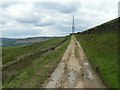
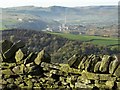
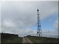
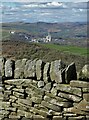
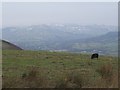
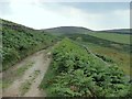
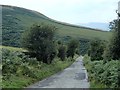
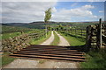
Living in Brough and Shatton offers a distinct experience defined by its compact scale and quiet character. This civil parish spans just 4.2 square kilometres, creating a very focused community where distances are short. The area sits within the Borough of East Riding of Yorkshire, providing a rural setting that feels separate from larger urban centres. Residents here typically enjoy a slower pace of life compared to the city of Hull, which lies nearby but at some distance. The local environment is unburdened by major planning constraints, meaning there are no designated Ramsar wetland sites or Areas of Outstanding Natural Beauty directly impacting development potential. You will find no protected woodlands or nature reserves within the parish boundaries that would restrict building plots. Safety scores indicate this is a secure place to reside, with low crime rates contributing to a peaceful atmosphere. Whether you are looking for homes in Brough and Shatton or simply seeking a quiet retreat, the small footprint provides a manageable community where neighbours often know each other. It is a location where the absence of sprawling infrastructure allows daily life to revolve around the immediate locality.
- Area Type
- Parish
- Area Size
- 4.2 km²
- Population
- Not available
- Population Density
- Not available
Demographics
The community in Brough and Shatton is characterised by a significantly older population profile. The median age reaches 70 years, marking it as an area dominated by retirees. This demographic shift influences who lives here and how daily life unfolds in this parish. A large portion of residents fall into the older age range, reflecting a settlement that has long been a destination for retirement rather than young families moving in for work. Financially, the area is highly stable regarding tenure, with 74% of households being owner-occupied. Fewer than one in ten residents rent their home, suggesting a strong sense of long-term root establishment. The district council records show the parish is census designated, meaning standard national classifications apply to the total population structure. Religious affiliations and predominant ethnic groups follow the broader national patterns typical of this region, though specific diversity data is not highlighted as a primary feature. The high rate of homeownership contrasts sharply with larger renter-heavy cities, indicating that those buying homes in Brough and Shatton intend to stay. This demographic stability means the local services and amenities cater primarily to an older demographic seeking a permanent residence.
Household Size
Accommodation Type
Tenure
Ethnic Group
Religion
Household Composition
Age
Household Deprivation
NS-SEC
Explore more demographic insights in this area
Go to Demographics tabPlanning
Planning Constraints
- Flood RiskPremium
- Ramsar Wetland SitesPremium
- Area of Outstanding Natural BeautyPremium
- Protected Nature ReservePremium
- Protected WoodlandPremium
- Crime RiskPremium