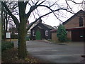
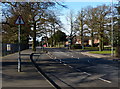
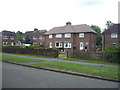
Area Overview for Broom Leys Ward
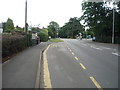
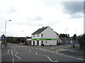
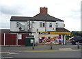
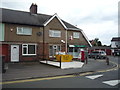
Photos of Broom Leys Ward
Area Information
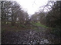
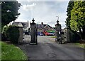
Living in Broom Leys Ward offers a quiet residential experience within a compact unitary authority area. This district covers 1.3 square kilometres, creating a tightly knit neighbourhood where residents enjoy a predictable and sheltered environment. The area is dominated by an older demographic, which shapes the local rhythm and community interactions. You will find a neighbourhood character defined by stability and long-term settlement rather than transient urban life. The size of the ward suggests a contained footprint, likely meaning short walks to local amenities and a distinct separation from the busier roads outside. The population profile indicates that the average resident is 70 years old. This demographic reality defines the daily atmosphere more than a typical city district. Families with young children may find the pace slower than they anticipate, while retirees will recognise the surroundings as familiar and welcoming. Broom Leys Ward prioritises established residency over rapid development. When considering homes in this sector, you are entering a space designed for settlement and continuity. The lack of major planning constraints within these boundaries supports this stable character.
- Area Type
- District Borough Unitary Ward
- Area Size
- 1.3 km²
- Population
- Not available
- Population Density
- Not available
Demographics
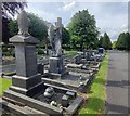
The community profile of Broom Leys Ward reflects a mature population structure. Data shows that the median age for residents is 70 years old. This figure places the area firmly within a senior-dominant category, where daily life centres on the needs and schedules of the older generation. The age range data confirms that the total population skews heavily towards this older cohort, creating a shared sense of community rooted in longevity and experience. Home ownership stands at 78 per cent, making this predominantly an owner-occupied locality. You should expect that most houses in Broom Leys Ward are paid for by the current occupants rather than rented on the open market. This high ownership rate usually correlates with greater investment in property maintenance and a stronger attachment to the local streets. Household composition and accommodation type statistics align with this ownership figure, indicating a stable housing stock where residents stay for decades. Ethnic diversity, religious affiliation, and deprivation levels are not detailed in the available records for this specific ward. Consequently, the demographic narrative relies entirely on the clear metrics of age and ownership. The absence of minority population data means the community appears to reflect the broader, older trends of the National Health Service catchment area. For a buyer entering Broom Leys Ward, the clearest signal is the dominance of older homeowners who have built their roots in the locality over many years.
Household Size
Accommodation Type
Tenure
Ethnic Group
Religion
Household Composition
Age
Household Deprivation
NS-SEC
Explore more demographic insights in this area
Go to Demographics tabPlanning
Planning Constraints
- Flood RiskPremium
- Ramsar Wetland SitesPremium
- Area of Outstanding Natural BeautyPremium
- Protected Nature ReservePremium
- Protected WoodlandPremium
- Crime RiskPremium