Area Overview for Brickhill and Queensway Ward
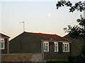
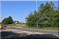
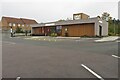
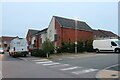
Photos of Brickhill and Queensway Ward


Area Information
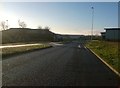
Brickhill and Queensway Ward is an electoral ward within the unitary authority of Milton Keynes, located in the East Midlands region of England. The area spans 5.3 km² and currently holds a population of 4,826 residents. It encompasses two distinct zones: Brickhill, which includes the village of Little Brickhill, and Queensway in Bletchley. The northern Buckinghamshire landscape here is an integration of modern city life and historical depth. You will find evidence of habitation dating back to the middle and late Stone Age around Brickhill. Iron Age earthworks, including the Danesborough fort, remain in Brickhill Woods. The history here serves as a tangible link to the past, with Little Brickhill's church founded in 1154. The more modern element lies in Queensway, where Bletchley Road was renamed in 1966. This transformation marked the beginning of high street development during plans for the new city of Milton Keynes. Daily life offers a mix of rural quiet in the woodland areas and urban convenience in Bletchley. You can access shops and professional premises via the developed high street at Queensway. The ward represents a specific slice of Milton Keynes where history and modern planning coexist. Living in this ward means you are part of a compact community with roots stretching back over two thousand years.
- Area Type
- District Borough Unitary Ward
- Area Size
- 5.3 km²
- Population
- 4826
- Population Density
- 904 people/km²
Demographics
The community in Brickhill and Queensway Ward is characterised by a very mature population. The median age of residents is 70 years, indicating a significant proportion of the population consists of older adults. You will likely find that neighbours are predominantly retirees or those in later life stages. Home ownership stands at 54 per cent, meaning slightly more than half the residents own their homes outright or via mortgage. This figure suggests a stable community where families have settled for the long term. The ward accommodates 4,826 people across its 5.3 km² area, resulting in a population density of 904 people per km². This density is moderate for an English ward, allowing for a quiet environment despite the proximity to Milton Keynes. Historical structures such as Warren Farm, which served as a traditional assize court site, reflect the long-standing ties residents have to the location. Little Brickhill Church, established in 1154, continues to serve the parish. The area does not provide specific breakdowns for household composition, predominant ethnic groups, or accommodation types in the public data. However, the high median age shapes the local culture and service needs. You are buying into an area where life moves at a pace suited to a senior demographic. The mix of historical sites and modern developments caters well to this established population.
Household Size
Accommodation Type
Tenure
Ethnic Group
Religion
Household Composition
Age
Household Deprivation
NS-SEC
Explore more demographic insights in this area
Go to Demographics tabPlanning
Planning Constraints
- Flood RiskPremium
- Ramsar Wetland SitesPremium
- Area of Outstanding Natural BeautyPremium
- Protected Nature ReservePremium
- Protected WoodlandPremium
- Crime RiskPremium