Area Overview for Breadsall
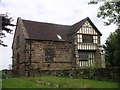
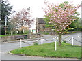
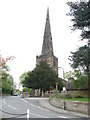
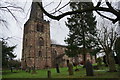
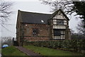
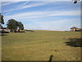
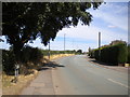
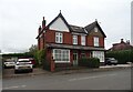
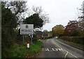
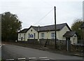
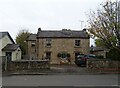
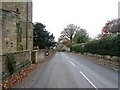
Photos of Breadsall
Area Information
Breadsall is a compact built-up area in England, covering 34.3 hectares. Its population skews older, with a median age of 70, suggesting a community rooted in long-term residency. The area is characterised by high home ownership—81% of residents own their homes—which indicates a stable, settled population. Daily life in Breadsall is shaped by its proximity to nearby towns and cities, with rail links to Derby, Duffield, and Spondon offering easy access to urban amenities. The presence of schools such as Breadsall CofE VC Primary School, rated good by Ofsted, ensures families have access to local education. While the area is small, its mix of retail outlets, including Co-op Breadsall and Morrisons Chester, provides essential services. Breadsall’s appeal lies in its balance of tranquillity and practical connectivity, making it a viable option for those seeking a quieter lifestyle without sacrificing accessibility. The low crime risk, with a safety score of 79, further enhances its appeal for homebuyers prioritising security.
- Area Type
- Built Up Area 250
- Area Size
- 34.3 hectares
- Population
- Not available
- Population Density
- Not available
Breadsall’s amenities include retail outlets such as Co-op Breadsall, Morrisons Chester, and Aldi Meteor RP, providing everyday shopping convenience. The nearby rail stations—Derby, Duffield, and Spondon—enhance mobility, allowing residents to access larger towns for leisure, dining, and employment. While the data does not mention parks or leisure facilities, the proximity to rail networks and retail options suggests a lifestyle focused on practicality and connectivity. The area’s small size means amenities are compact, but the availability of essential services and transport links ensures residents can access a broader range of opportunities beyond Breadsall itself.
Amenities
Schools
Breadsall’s educational landscape includes Breadsall CofE VC Primary School, which holds a good Ofsted rating, offering families a reliable local option. Nearby, special schools such as Brookside School and Ferriby School cater to specific educational needs, while other institutions like Tuition Services Co Brookside School and Breadsall Support Centre provide additional support services. This mix of school types ensures a range of options for parents, from mainstream primary education to specialist provision. The presence of both primary and special schools suggests the area is well-suited for families with diverse needs, though the absence of secondary schools means students may need to commute to nearby towns for further education.
| Rank | School | Type | Entry gender | Ages |
|---|
Explore more schools in this area
Go to Schools tabDemographics
Breadsall’s population is predominantly older, with a median age of 70. This suggests a community where many residents have lived for decades, contributing to a sense of continuity. Home ownership is exceptionally high at 81%, reflecting a preference for long-term residency over rental properties. The data does not specify household composition or ethnic diversity, but the overall profile indicates a mature demographic. The absence of detailed breakdowns on accommodation types or deprivation levels means the area’s socioeconomic nuances remain less defined. However, the high home ownership rate implies a stable housing market, with fewer transient residents. For those considering Breadsall, the demographic profile suggests a quiet, established community where property values are likely to hold their value.
Household Size
Accommodation Type
Tenure
Ethnic Group
Religion
Household Composition
Age
Household Deprivation
NS-SEC
Explore more demographic insights in this area
Go to Demographics tabPlanning
Planning Constraints
- Crime RiskPremium