Area Overview for Braunstone Park & Rowley Fields Ward
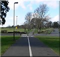
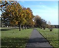
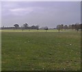
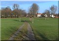
Photos of Braunstone Park & Rowley Fields Ward
Area Information
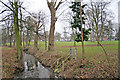
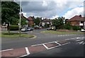
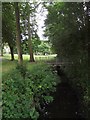
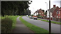
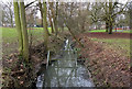
Braunstone Park & Rowley Fields Ward is a compact district borough unitary ward covering 4.8 km² in England. It houses a population of 1,706 residents, creating a relatively quiet environment with 359 people per square kilometre. Living in Braunstone Park & Rowley Fields Ward involves navigating a small but defined community where daily life is characterised by low density. The area does not contain Ramsar wetland sites, Areas of Outstanding Natural Beauty, or protected nature reserves, which simplifies planning constraints for development while maintaining specific environmental protections. This ward contains protected woodland, adding a layer of green infrastructure to the landscape. Residents benefit from a safety score of 8.95 regarding flood risk, indicating low flood risk coverage is the norm. However, potential buyers should note the medium crime risk score of 39 out of 100, which suggests standard security precautions are advisable. Homes in Braunstone Park & Rowley Fields Ward cater to a population with a median age of 70, reflecting a settlement that has evolved over time. The combination of limited open space designations and an older demographic creates a distinct atmosphere where existing infrastructure serves a stable, long-term community.
- Area Type
- District Borough Unitary Ward
- Area Size
- 4.8 km²
- Population
- 1706
- Population Density
- 359 people/km²
Demographics
The community in Braunstone Park & Rowley Fields Ward is defined by a median age of 70, meaning the majority of residents are older than the national average. This age profile suggests a retirement-friendly environment where daily routines and local services cater primarily to seniors. With a median age of 70, the ward lacks the youthful energy found in cities transitioning industries. Home ownership stands at 40 per cent, indicating that a significant majority of houses in Braunstone Park & Rowley Fields Ward are rented rather than owner-occupied. This contrasts with family-dense areas where ownership typically exceeds 60 per cent. The ward covers 4.8 km² but contains only 1,706 people, resulting in a population density of 359 people per km². This low density reinforces the quiet nature of living in Braunstone Park & Rowley Fields Ward. Accommodation types and household composition data are aggregated under total categories, preventing a detailed breakdown of family versus single-person homes. Despite the lack of specific ethnic or religious data points, the ward remains a distinct community entity within the borough. For those considering demographics, the high age rating and rental dominance are the most critical factors shaping social interactions and local economy.
Household Size
Accommodation Type
Tenure
Ethnic Group
Religion
Household Composition
Age
Household Deprivation
NS-SEC
Explore more demographic insights in this area
Go to Demographics tabPlanning
Planning Constraints
- Flood RiskPremium
- Ramsar Wetland SitesPremium
- Area of Outstanding Natural BeautyPremium
- Protected Nature ReservePremium
- Protected WoodlandPremium
- Crime RiskPremium