Area Overview for Brant Broughton and Stragglethorpe
Photos of Brant Broughton and Stragglethorpe
Area Information
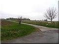
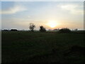
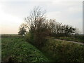
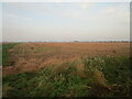
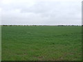
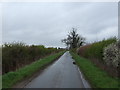
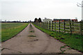
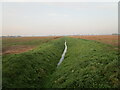
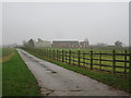
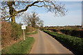
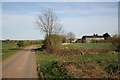
Brant Broughton and Stragglethorpe is a small civil parish covering 15.1 km² in England. You will find this area feels very different from busy urban centres due to its limited size and quiet countryside setting. The community is defined by an older population and a strong focus on living within your own home rather than renting. You can expect a lifestyle that revolves around rural living rather than city life, with fewer amenities immediately on your doorstep. This lack of development is also one of the area's defining characteristics, meaning access to shops or entertainment in the village centres may require a short drive. Living in Brant Broughton and Stragglethorpe means accepting a remote location exchange for peace and quiet. The parish does not offer the immediate convenience of large shopping malls or movie theatres found in larger towns. Instead, daily life revolves around local village interactions and the surrounding landscape. If you are considering homes in Brant Broughton and Stragglethorpe, you must understand that this is a settled area where change happens slowly. The environment prioritises property preservation over new commercial construction. This stability appeals to those seeking a traditional English rural experience away from major motorways or transport hubs.
- Area Type
- Parish
- Area Size
- 15.1 km²
- Population
- Not available
- Population Density
- Not available
Demographics
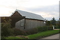
The community in Brant Broughton and Stragglethorpe has a distinctively mature population profile. Residents here have a median age of 70, indicating this is an area dominated by older adults and retirees. The demographic makeup suggests that families with young children are less common compared to other regions. Home ownership stands at 81%, which is exceptionally high compared to the national average. This figure confirms that the vast majority of households have purchased their properties rather than renting. High home ownership levels usually correlate with long-term residents who have stayed in the area for decades. You are unlikely to find large blocks of social housing or student accommodation in this parish. The accommodation types reflect this, with detached or semi-detached properties likely forming the bulk of the housing stock given the ownership rate. This concentration of owners creates a stable neighbourhood where people often know one another. However, the age profile also means local services might cater primarily to seniors rather than young professionals. If you are looking at schools near Brant Broughton and Stragglethorpe, note that the catchment area serves a population with few school-age children.
Household Size
Accommodation Type
Tenure
Ethnic Group
Religion
Household Composition
Age
Household Deprivation
NS-SEC
Explore more demographic insights in this area
Go to Demographics tabPlanning
Planning Constraints
- Flood RiskPremium
- Ramsar Wetland SitesPremium
- Area of Outstanding Natural BeautyPremium
- Protected Nature ReservePremium
- Protected WoodlandPremium
- Crime RiskPremium