Area Overview for Brampton
Photos of Brampton
Area Information
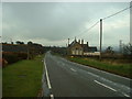
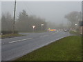
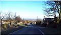
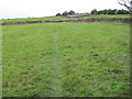
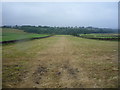
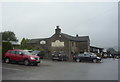
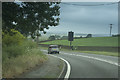
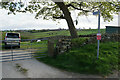
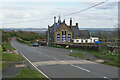
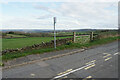
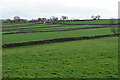
Living in Brampton means residing within a civil parish that spans 21.0 km² of North East Derbyshire. This rural area lies approximately 2 miles west of the market town of Chesterfield and encompasses part of the Peak District National Park to the west. The parish comprises three distinct village centres: Old Brampton, Wadshelf, and Cutthorpe. These settlements form a semi-ruble community with commanding views, contrasting sharply with the suburban Brampton located to the east which centres on Chatsworth Road. The parish is bounded by natural features including the Sud Brook to the north and Holme Brook to the east, while the A619 road runs along the southern boundary. Historical records indicate the area has medieval origins, with the Church of St Peter and St Paul dating back to 1253. While the industrial heritage includes former iron foundries and potteries along the River Hipper, the current character is defined by its countryside setting and inclusion of protected nature reserves and woodland. The population recorded at the 2011 census was 1,201, reflecting a quiet, rural lifestyle anchored by historic architecture and proximity to the Peak District National Park.
- Area Type
- Parish
- Area Size
- 21.0 km²
- Population
- Not available
- Population Density
- Not available
Demographics
The community profile of Brampton reveals a distinctly older population characterised by a median age of 70. This demographic skew suggests the village serves primarily as a retirement destination or early retirement location rather than a hub for young families or commuters. Home ownership stands at an exceptionally high level of 78%, indicating that the vast majority of households own their properties outright or via a mortgage without facing the challenges of the private rental sector. You will find very few tenant households within the parish boundaries, creating a stable community where long-term residents dominate local decision-making. The recorded population of 1,201 from the 2011 census supports a small, close-knit social environment typical of rural Derbyshire villages. While specific data on household composition types, predominant ethnic groups, and religious affiliation are covered in the general statistics as total figures, the high ownership rate and mature age profile point towards a settled community. Buyers should expect a neighbourhood where neighbours have lived for decades, fostering a traditional village atmosphere away from the transient nature of urban areas.
Household Size
Accommodation Type
Tenure
Ethnic Group
Religion
Household Composition
Age
Household Deprivation
NS-SEC
Explore more demographic insights in this area
Go to Demographics tabPlanning
Planning Constraints
- Flood RiskPremium
- Ramsar Wetland SitesPremium
- Area of Outstanding Natural BeautyPremium
- Protected Nature ReservePremium
- Protected WoodlandPremium
- Crime RiskPremium