Area Overview for Brafield-on-the-Green
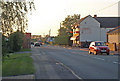
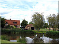
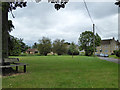
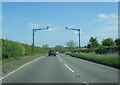
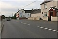
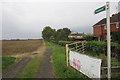
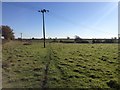
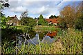
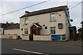
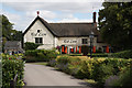
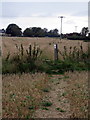
Photos of Brafield-on-the-Green
Area Information
Brafield-on-the-Green is a compact built-up area in England, covering 27.6 hectares and serving as a quiet, well-defined community. Its size suggests a focused, localised character, with amenities and services clustered closely. The area’s median age of 70 indicates a population skewed towards older residents, which shapes the community’s rhythm and priorities. Daily life here likely revolves around local shops, transport links, and the nearby Brafield CofE Primary School, which serves the area’s younger families. While the data does not specify the exact composition of households or ethnic diversity, the 70% home ownership rate suggests a stable, long-term resident base. For those considering living in Brafield-on-the-Green, the combination of a low crime risk and accessible transport options, including a railway station and bus interchanges, may appeal to those seeking a peaceful yet connected lifestyle. The area’s proximity to retail hubs like Asda Nene Valley and Co-op Bellinge adds to its practicality, making it a viable choice for those prioritising convenience and safety.
- Area Type
- Built Up Area 250
- Area Size
- 27.6 hectares
- Population
- Not available
- Population Density
- Not available
Residents of Brafield-on-the-Green have access to a range of amenities within practical reach. Nearby retail options include Co-op Bellinge and two Asda branches, Nene Valley and another unnamed Asda, providing choices for grocery shopping and daily essentials. The area is served by two bus interchanges: Northampton Bus Interchange and University Bus Interchange, offering connections to local and regional destinations. Northampton Railway Station is also nearby, enabling travel to larger cities and towns. While the data does not specify parks or leisure facilities, the presence of a primary school and retail hubs suggests a community-oriented lifestyle. The convenience of these amenities, combined with the area’s low crime risk, may appeal to those seeking a balanced mix of practicality and safety. The compact nature of Brafield-on-the-Green ensures that most needs can be met without long journeys, enhancing the quality of daily life.
Amenities
Schools
The nearest school to Brafield-on-the-Green is Brafield CofE Primary School, which serves the local community with primary education. No further details on its Ofsted rating or specific performance are provided, so its quality remains unspecified. The presence of a primary school suggests that the area is suitable for families with young children, though the lack of secondary schools or other educational institutions nearby may require residents to travel for higher education. The data does not indicate the number of schools or their types beyond this primary school, meaning the full range of educational options is not clear. For families prioritising proximity to schools, Brafield CofE Primary School is a key feature, but additional research would be needed to assess its performance or the availability of other educational facilities.
| Rank | School | Type | Entry gender | Ages |
|---|
Explore more schools in this area
Go to Schools tabDemographics
The population of Brafield-on-the-Green has a median age of 70, which is notably higher than the national average. This suggests a community where older residents form a significant proportion, potentially influencing local services and social dynamics. The home ownership rate stands at 70%, indicating that most residents live in properties they own rather than rent. However, the data does not specify the types of households or the distribution of accommodation, such as whether properties are terraced, semi-detached, or detached. The predominant ethnic group and religious composition are also not detailed, meaning the area’s cultural diversity remains unquantified. While the lack of specific data on deprivation or income levels means we cannot assess economic challenges directly, the high home ownership rate and low crime risk imply a relatively stable environment. For prospective buyers, this demographic profile may align with those seeking a mature, low-maintenance community with established infrastructure.
Household Size
Accommodation Type
Tenure
Ethnic Group
Religion
Household Composition
Age
Household Deprivation
NS-SEC
Explore more demographic insights in this area
Go to Demographics tabPlanning
Planning Constraints
- Crime RiskPremium