Area Overview for Brackenfield
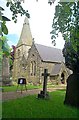
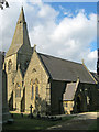
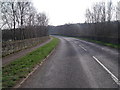
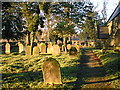
Photos of Brackenfield
Area Information
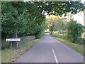
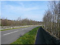
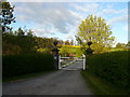
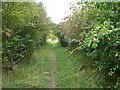
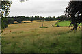
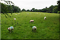
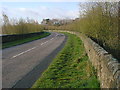
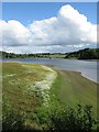
Living in Brackenfield defines a distinctly rural and established way of life within a civil parish of Buckinghamshire. This area covers 6.3 km², offering a compact footprint that prioritises quiet domesticity over urban convenience. The community is characterised by a high level of residential stability, reflected in a median age of 70. This demographic profile suggests a settlement designed for those who have built a permanent home rather than transient residents seeking a stepping stone. You will find daily life here revolves around a slower pace, where the local landscape and immediate neighbours form the primary focus of existence. The parish functions independently as a local unit, separate from the broader commercial hubs of the surrounding county. Families here may find the environment more suited to retirement or to those seeking long-term quiet compared to the energy of nearby towns. The small geographical size means that travel times between homes are short, and the sense of place remains tightly knit. When considering Brackenfield, you are looking at a location where the built environment serves a population that has lived here for decades. The area does not offer typical city amenities within its immediate bounds, relying instead on the wider surrounding infrastructure for larger services. This summary captures the essence of a place where the past strongly influences the present rhythm of life.
- Area Type
- Parish
- Area Size
- 6.3 km²
- Population
- Not available
- Population Density
- Not available
Demographics
The community in Brackenfield presents a clear demographic picture dominated by older residents and established homeowners. A full 73% of the population owns their homes, indicating a neighbourhood shaped by long-term ownership rather than a high-velocity rental market. This high rate of home ownership correlates with the area's median age of 70, confirming that most residents are in their late sixties or older. The age data shows that the total age group constitutes the single most common demographic range, reinforcing the dominance of seniors in the local population. You will encounter very few young families or students, as the area does not appear to attract a younger workforce seeking entry-level housing. The household composition aligns with this older profile, meaning many properties likely support single-person households or couples without dependent children. While the data does not specify ethnic breakdown or religious affiliation in detail, the dominance of the oldest age group suggests a settled community with deep local roots. This demographic reality impacts local business needs, leisure activities, and social groups available within Brackenfield. Buyers seeking active playgrounds or bars for young people may find the offerings limited compared to areas with a younger population. Conversely, those seeking a quiet retirement setting will find the age profile matches their lifestyle expectations perfectly. The statistics provide a reliable indicator of who has lived here for a generation.
Household Size
Accommodation Type
Tenure
Ethnic Group
Religion
Household Composition
Age
Household Deprivation
NS-SEC
Explore more demographic insights in this area
Go to Demographics tabPlanning
Planning Constraints
- Flood RiskPremium
- Ramsar Wetland SitesPremium
- Area of Outstanding Natural BeautyPremium
- Protected Nature ReservePremium
- Protected WoodlandPremium
- Crime RiskPremium