Area Overview for Bourne East Ward
Photos of Bourne East Ward
Area Information
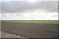
Bourne East Ward sits within South Kesteven as an electoral ward covering the eastern half of the market town of Bourne. This district lies in Lincolnshire's East Midlands, positioned at coordinates 52.7768, -0.3180. It spans 25.1 km² and includes postcodes from PE10 9GQ to PE10 9ZD. The ward occupies the eastern section of Bourne near the western edge of the Fens and the eastern slopes of the Kesteven Uplands. Living here means navigating a historic market town that blends rural surroundings with local commerce. Residents enjoy access to the market town's central facilities while remaining within this specific administrative boundary. The location offers a distinct setting defined by its geographical transition between wetland areas and upland slopes. Prospective homebuyers should note that this is a defined political and geographical entity rather than a standalone village. Daily life revolves around the established layout of Bourne and its connection to the wider South Kesteven district council area. The ward provides a clear, contained living environment for those seeking the town's amenities without stepping outside its official boundaries.
- Area Type
- District Borough Unitary Ward
- Area Size
- 25.1 km²
- Population
- Not available
- Population Density
- Not available
Demographics
The community profile of Bourne East Ward points to an older population. The median age for residents is 70, indicating a significant portion of the demographic consists of older adults. Age data confirms that the total population skews heavily towards this older bracket. Home ownership stands at 63%, meaning the majority of households own their properties outright or with a mortgage. This high rate of owner occupancy suggests long-term residents have established roots in the ward. Household composition and accommodation type data indicate a stable residential base without specific breakdowns into family structures or single-person homes. The ethnic composition, religious makeup, and detailed household statistics are marked as totals in the available records, reflecting the overall population count but omitting granular diversity metrics. You live in a neighbourhood where property tenure is predominantly owner-occupied. The high median age suggests a community that may cater to retirement living or later-life stages. When evaluating living in Bourne East Ward, you should understand that the primary demographic is elderly. This age profile influences local services and community engagement. The 63% home ownership figure is a key statistic for understanding financial stability and tenure types in this specific ward.
Household Size
Accommodation Type
Tenure
Ethnic Group
Religion
Household Composition
Age
Household Deprivation
NS-SEC
Explore more demographic insights in this area
Go to Demographics tabPlanning
Planning Constraints
- Flood RiskPremium
- Ramsar Wetland SitesPremium
- Area of Outstanding Natural BeautyPremium
- Protected Nature ReservePremium
- Protected WoodlandPremium