Area Overview for Bourne Austerby Ward
Photos of Bourne Austerby Ward
Area Information
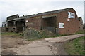
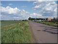
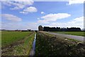
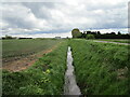
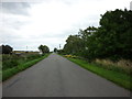
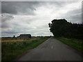
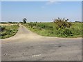
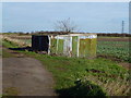
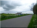
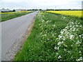
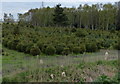
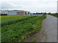
Bourne Austerby Ward represents a distinctive residential district on the edge of the Fens, covering an area of 9.7 square kilometres. This electoral ward encompasses the suburb of Austerby, which evolved from a separate village to become an integrated part of the market town of Bourne. Historically significant for its location along the Roman road of King Street and the ancient canal of Car Dyke, the area blends local heritage with modern suburban development. You will find housing developments along public highways maintained by Lincolnshire Council, offering a sense of rootedly established neighbourhood character. The ward sits near key local attractions such as Abbey Lawn, which features an outdoor swimming pool, and the extensive Bourne Woods, one of South Lincolnshire's largest forests. Living in Bourne Austerby Ward means residing in a community where Austerby's history as an independent settlement is now woven into the fabric of the larger town of roughly 18,000 people. The area attracts residents who value proximity to the town centre while enjoying a quieter suburban setting. You benefit from being close to a designated conservation area around the historic buildings of Bourne, ensuring the landscape retains its charm. Whether you require access to South Fen Road towards Tongue End or the direct route to Peterborough via the A15, your location offers versatile connectivity. The mapping data notes the level of detail and development in this area as good, suggesting a well-serviced environment for daily living.
- Area Type
- District Borough Unitary Ward
- Area Size
- 9.7 km²
- Population
- Not available
- Population Density
- Not available
Demographics
The community profile of Bourne Austerby Ward reflects a settled population with a median age of 70 years. This demographic reality shapes the daily rhythm of the ward, indicating that a significant portion of residents are retirees or older adults. Age data confirms that the majority of the population falls within the older age brackets, creating a neighbourhood where quiet and stability often take precedence. Home ownership stands at a high rate of 74% for this ward, meaning you are far more likely to find permanent residents than short-term tenants. This statistic suggests a deeply embedded local community where people have long-term ties to their streets. Household composition and accommodation types within Bourne Austerby Ward align with these ownership figures, reflecting a stable residential pattern. The area does not show the same fluidity of population turnover found in younger university towns or high-rental hubs. Instead, the 74% ownership rate signals that most homes in Bourne Austerby Ward are lived in by their owners. This stability often translates into maintained properties and a neighbourhood where long-term neighbours know each other well. The predominance of owner-occupied homes also influences local services and community engagement, as residents often invest directly in the upkeep of their immediate surroundings. For you as a potential buyer, this means entering a market driven by those who intend to stay for the foreseeable future.
Household Size
Accommodation Type
Tenure
Ethnic Group
Religion
Household Composition
Age
Household Deprivation
NS-SEC
Explore more demographic insights in this area
Go to Demographics tabPlanning
Planning Constraints
- Flood RiskPremium
- Ramsar Wetland SitesPremium
- Area of Outstanding Natural BeautyPremium
- Protected Nature ReservePremium