Area Overview for Boothby Pagnell
Photos of Boothby Pagnell


Area Information
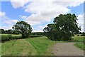
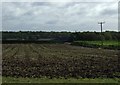
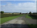
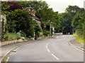
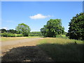
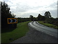
Living in Boothby Pagnell means calling a small, defined parish home where the physical boundaries span just 7.3 square kilometres of land. This civil parish sits in England, offering a compact footprint that fosters a close-knit environment rather than a sprawling urban experience. You can navigate the entire area quickly, which is ideal if you prefer to have your daily amenities within a short drive or walk. The village is characterised by a quiet, rural setting that avoids the density often found in larger settlements. Prospective buyers will find that homes in Boothby Pagnell are situated in an setting prioritises space and local community interaction over city-centre convenience. The geography of the parish is straightforward, avoiding complex planning constraints like Ramsar wetland sites or Areas of Outstanding Natural Beauty, meaning development follows standard local regulations without additional ecological hurdles. For families or retirees seeking a settled life, the scale of the parish provides a predictable environment. While the area lacks a massive population count in the data, the ownership statistics suggest a stable, long-term resident base rather than a transient population. You are looking at a place where the commitment to property is high, creating a stable neighbourhood atmosphere. The area size ensures you are not buried in a commuter belt but are instead situated in a distinct, manageable community that functions as a self-contained unit for daily living.
- Area Type
- Parish
- Area Size
- 7.3 km²
- Population
- Not available
- Population Density
- Not available
Demographics
The community profile of Boothby Pagnell reflects a mature population with a median age of 70 years old. This demographic skew indicates that the local people are predominantly older adults, which shapes the village's character and available services. You are likely to encounter residents who have put down roots for decades, resulting in a stable social fabric. Specific age data ranges beyond the median are not detailed, but the high median confirms that young families are not the primary demographic driving the local economy or culture today. Regarding household composition and accommodation types, specific breakdown figures are not available in the current records, so you must assess these factors based on local observation rather than comprehensive census-style stats. However, the diversity of the population regarding predominant ethnic groups and religion is not explicitly quantified in the source material, though the area generally reflects national averages for rural English parishes. The most telling statistic is the home ownership rate, which stands at 67 per cent. This figure is significantly higher than the national average, indicating that two-thirds of households own their properties outright or through a mortgage rather than renting. This high level of ownership suggests a community invested in their immediate surroundings, often leading to better maintained housing stock and a stronger sense of civic responsibility among the residents of Boothby Pagnell.
Household Size
Accommodation Type
Tenure
Ethnic Group
Religion
Household Composition
Age
Household Deprivation
NS-SEC
Explore more demographic insights in this area
Go to Demographics tabPlanning
Planning Constraints
- Flood RiskPremium
- Ramsar Wetland SitesPremium
- Area of Outstanding Natural BeautyPremium
- Protected Nature ReservePremium
- Protected WoodlandPremium
- Crime RiskPremium