Area Overview for Bonsall & Winster Ward
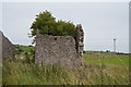
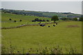
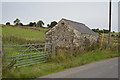
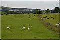
Photos of Bonsall & Winster Ward
Area Information
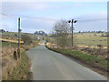
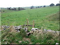
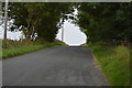
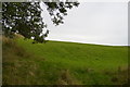
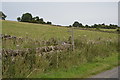
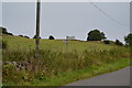
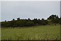
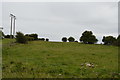
Living in Bonsall & Winster Ward offers a distinctly rural experience situated within Derbyshire Dales District Council in the East Midlands. This district borough unitary ward spans 32.4 km², placing it centrally in Derbyshire near coordinates that sit close to the Peak District. The area encompasses the civil parishes of Bonsall and Winster, with local life revolving around quiet villages rather than urban density. You find yourself surrounded by open countryside, with the wider landscape defined by its proximity to Matlock and connections to towns like Bakewell, Wirksworth, and Youlgrave. Transport links rely heavily on local bus services such as routes 90, 90A, and 9.3, as there are no direct railway stations identified within the ward itself. Access to Derby or Chesterfield requires travel via roads like the A6. Your daily life involves relying on these road networks and connecting for local shops, while the overall environment prioritises peace and close proximity to nature over city convenience.
- Area Type
- District Borough Unitary Ward
- Area Size
- 32.4 km²
- Population
- Not available
- Population Density
- Not available
Demographics
The community in Bonsall & Winster Ward is heavily skewed towards older residents, with a median age of 70 years. This demographic profile suggests an area where many families have moved on or aged in place over several decades. As a result, the most common age range reported in the census data is simply labelled as 'Age: Total', indicating the ward does not have a large population of young adults or children. Despite this older profile, the area remains socially stable with a high rate of resident independence. Home ownership stands at 78%, meaning the vast majority of properties are owned outright rather than rented. This figure indicates a stable community with little tenant turnover. The data does not specify predominant ethnic groups, household composition breakdowns, or religious affiliations, but the high ownership rate suggests a settled, long-term population. For someone considering this location, the large number of private owners points towards an established neighbourhood rather than a transient estate.
Household Size
Accommodation Type
Tenure
Ethnic Group
Religion
Household Composition
Age
Household Deprivation
NS-SEC
Explore more demographic insights in this area
Go to Demographics tabPlanning
Planning Constraints
- Flood RiskPremium
- Ramsar Wetland SitesPremium
- Area of Outstanding Natural BeautyPremium
- Protected Nature ReservePremium
- Protected WoodlandPremium
- Crime RiskPremium