Area Overview for Bolsover South Ward
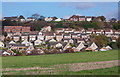
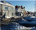
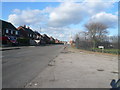
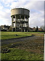
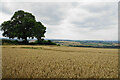
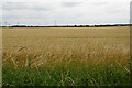
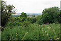
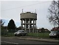
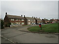
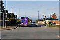
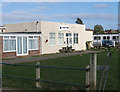
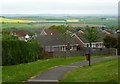
Photos of Bolsover South Ward
Area Information
Bolsover South Ward is a compact district borough unitary ward covering 4.6 km² in Derbyshire's East Midlands. This electoral ward sits within the Bolsover District, centred around the town of Bolsover at coordinates approximately 53.22°N, 1.29°W. You will find that the population size has remained remarkably stable over recent decades, hovering consistently around 4,450 residents according to census figures from 2001, 2011, and 2021. Living in Bolsover South Ward means residing in a small footprint community that has not seen significant growth or decline since the early 2000s. The ward forms part of the wider Bolsover UK Parliament constituency, tying local affairs to broader regional governance. Your daily life here takes place within a defined boundary that balances urban features with the character of a smaller community. The area serves as a focal point for residents who value a stable demographic environment rather than rapid expansion. You are entering a settled area where the physical boundaries remain fixed while the community adapts to the needs of its long-term inhabitants.
- Area Type
- District Borough Unitary Ward
- Area Size
- 4.6 km²
- Population
- Not available
- Population Density
- Not available
Demographics
The community within Bolsover South Ward is defined by a very mature age profile, with a median age of 70 years. This statistic indicates that the neighbourhood primarily serves older residents rather than young families or students. You must consider how this age distribution shapes local services, leisure options, and the general pace of life when evaluating homes in Bolsover South Ward. Home ownership stands at 68 per cent, showing a strong preference for outright ownership among those living here. This high level of equity often correlates with the older demographic, suggesting many residents have lived in their properties for extended periods. While the specific accommodation types and household composition categories are noted in available records, the dominant trends point toward established households rather than transient populations. The area does not currently show data on predominant ethnic groups or religious affiliations, meaning the demographic picture relies heavily on age and tenure figures for analysis. You should factor in that the social fabric is likely woven by long-term residents who have settled into this specific ward structure.
Household Size
Accommodation Type
Tenure
Ethnic Group
Religion
Household Composition
Age
Household Deprivation
NS-SEC
Explore more demographic insights in this area
Go to Demographics tabPlanning
Planning Constraints
- Flood RiskPremium
- Ramsar Wetland SitesPremium
- Area of Outstanding Natural BeautyPremium
- Protected Nature ReservePremium
- Protected WoodlandPremium
- Crime RiskPremium