Area Overview for Blyton
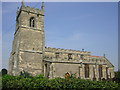
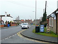
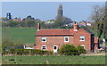
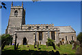
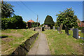
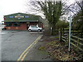
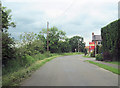
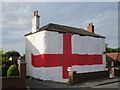
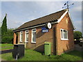
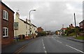
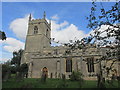
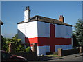
Photos of Blyton
Area Information
Living in Blyton offers a compact, well-defined community within a 31.4-hectare built-up area in England. The area’s demographic profile is notable for its median age of 70, suggesting a population skewed towards older adults. This shapes daily life, with a focus on stability and established routines. Blyton’s proximity to Gainsborough Central Railway Station and other nearby rail links provides practical connectivity, while the presence of five retail outlets, including Lincolnshire Co-operative Co and Spar, ensures basic shopping needs are met within reach. A primary school, Blyton Cum Laughton Church of England School, rated ‘good’ by Ofsted, serves the local community, offering families a reliable educational option. The area’s safety score of 67/100 indicates a below-average crime risk, contributing to a sense of security. However, broadband quality is poor, scoring 5/100, which may impact those reliant on high-speed internet for work or leisure. Despite this, Blyton’s blend of practical amenities, rail access, and a relatively safe environment makes it a viable option for those seeking a settled, low-maintenance lifestyle.
- Area Type
- Built Up Area 250
- Area Size
- 31.4 hectares
- Population
- Not available
- Population Density
- Not available
Blyton’s lifestyle is shaped by its proximity to essential amenities. The five retail outlets, including Lincolnshire Co-operative Co and Spar, provide access to groceries and daily necessities within walking distance. The three nearby railway stations enhance mobility, connecting residents to broader networks for work, shopping, or leisure. While the data does not mention parks or recreational spaces, the presence of retail and rail services suggests a community focused on practicality and convenience. The absence of detailed information on leisure facilities means buyers should explore local listings for parks or community centres. Overall, Blyton offers a straightforward lifestyle with accessible shopping and transport options, though those prioritising extensive leisure amenities may need to look beyond the immediate area.
Amenities
Schools
The nearest school to Blyton is Blyton Cum Laughton Church of England School, a primary institution with a ‘good’ Ofsted rating. This school serves the local community, providing a reliable educational option for families with young children. The presence of a single primary school suggests that secondary education may require commuting to nearby towns, but the ‘good’ rating indicates a strong foundation in early education. For families prioritising quality schooling, this is a key factor in considering Blyton as a place to live. The school’s rating also reflects the area’s commitment to education, though the absence of additional schools in the data means no further details on educational diversity or capacity are available.
| Rank | A + A* % | School | Type | Entry gender | Ages |
|---|---|---|---|---|---|
| 1 | N/A | Blyton Cum Laughton Church of England School | primary | N/A | N/A |
Explore more schools in this area
Go to Schools tabDemographics
Blyton’s population is predominantly composed of individuals aged 70 and above, with the most common age range encompassing all demographics. This high median age suggests a community where retirement and long-term residency are prevalent. Home ownership is strong, with 73% of residents owning their homes, indicating a stable housing market and a lack of significant rental demand. The data does not specify household composition or accommodation types, but the overall profile points to a settled, older population. While no specific figures on ethnic diversity or deprivation are provided, the absence of such data means these aspects remain unexplored in this analysis. The age demographic likely influences local services, with healthcare and leisure facilities tailored to older adults. For prospective buyers, this suggests a community with a distinct character, shaped by its demographic makeup and the prevalence of owner-occupied properties.
Household Size
Accommodation Type
Tenure
Ethnic Group
Religion
Household Composition
Age
Household Deprivation
NS-SEC
Explore more demographic insights in this area
Go to Demographics tabPlanning
Planning Constraints
- Crime RiskLocked