Area Overview for Bleasby
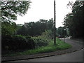
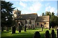
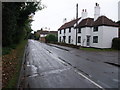
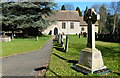
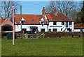
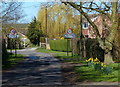
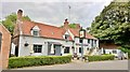
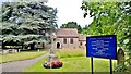
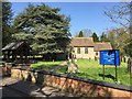
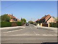
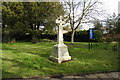
Photos of Bleasby

Area Information
Living in Bleasby offers a quiet, compact environment within a built-up area spanning 43.2 hectares. The community is characterised by a median age of 70, suggesting a population skewed towards older residents. This is a place where daily life unfolds with a sense of stability, supported by a high rate of home ownership—90% of properties are owner-occupied. Bleasby’s proximity to nearby towns and practical access to amenities make it a viable choice for those seeking a low-maintenance lifestyle. While the area lacks the vibrancy of larger urban centres, its smaller scale ensures a slower pace, with fewer crowds and a focus on local needs. Residents benefit from nearby railway stations, including Bleasby, Thurgarton, and Fiskerton, which connect to broader networks. The presence of two primary schools, both named Bleasby CofE Primary School, underscores the area’s commitment to education for younger families. For those prioritising safety and simplicity, Bleasby’s low crime risk and established infrastructure provide a straightforward, no-frills living experience.
- Area Type
- Built Up Area 250
- Area Size
- 43.2 hectares
- Population
- Not available
- Population Density
- Not available
Bleasby’s lifestyle is defined by its proximity to practical amenities. The five nearby railway stations, including Bleasby and Fiskerton, offer easy access to regional transport networks, facilitating travel to larger towns or cities. Retail options are conveniently located, with shops like M&S Southwell Green BP and Co-op Southwell providing essentials. While the area lacks expansive parks or leisure facilities, its compact nature ensures a straightforward, no-frills experience. The presence of two primary schools reinforces the community’s focus on family needs, though secondary education requires commuting. Residents benefit from reliable digital connectivity, with excellent broadband and mobile coverage supporting both professional and personal activities. The area’s character is one of simplicity, where daily life revolves around local services and a stable, low-maintenance environment.
Amenities
Schools
Bleasby has two primary schools: Bleasby CofE Primary School and Bleasby Church of England Primary School. Both are primary institutions, though no Ofsted ratings are provided in the data. The presence of two schools in the area may indicate a focus on early education, though the lack of secondary schools suggests families may need to look beyond Bleasby for secondary education. The duplication of school names in the data—both referencing "Bleasby CofE"—could imply either a naming oversight or a single school with multiple entries. Regardless, the availability of primary education within the area supports families seeking convenience for younger children. However, the absence of secondary schools means prospective buyers should consider proximity to larger towns for comprehensive schooling.
| Rank | A + A* % | School | Type | Entry gender | Ages |
|---|---|---|---|---|---|
| 1 | N/A | Bleasby CofE Primary School | primary | N/A | N/A |
| 2 | N/A | Bleasby Church of England Primary School | primary | N/A | N/A |
Explore more schools in this area
Go to Schools tabDemographics
Bleasby’s population has a median age of 70, with the most common age range encompassing all demographics. This suggests a community where older residents form a significant proportion, though the data does not specify the distribution of age groups beyond this aggregate. Home ownership is exceptionally high at 90%, indicating a settled population with long-term residency. The household composition and accommodation types are listed as totals, meaning no breakdown is available for family structures or property types. The predominant ethnic group and religious affiliations are also aggregated, offering no insight into diversity. While the data does not include deprivation metrics, the high home ownership rate and low crime risk imply a stable, low-risk environment. However, the lack of detailed demographic breakdowns means assumptions about community dynamics must be avoided.
Household Size
Accommodation Type
Tenure
Ethnic Group
Religion
Household Composition
Age
Household Deprivation
NS-SEC
Explore more demographic insights in this area
Go to Demographics tabPlanning
Planning Constraints
- Crime RiskLocked