Area Overview for Blackwell in the Peak
Photos of Blackwell in the Peak
Area Information
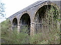
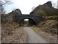
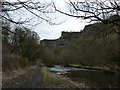
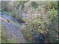
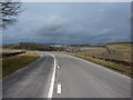
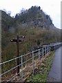
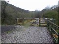
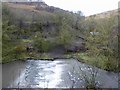
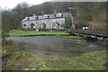
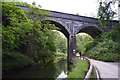
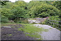
Blackwell in the Peak is a distinct civil parish located in the Peak District of England. The area covers 4.4 km², creating a compact community where daily life revolves around a close-knit environment. Living in Blackwell in the Peak means navigating a landscape defined by its rural character rather than urban density. The parish offers a quiet existence away from the pace of larger towns, appealing to those seeking stability and peace. You will find yourself in an established part of the countryside where the surroundings dictate the rhythm of the day. The scale of the area ensures that local features have a significant impact on the experience of residents. This setting separates Blackwell in the Peak from more commercialised zones found elsewhere in the county. Prospective buyers will appreciate the defined boundaries of this 4.4 km² zone. The location provides a clear sense of identity without the isolation often associated with remote locations. You are accessing a specific slice of the Peak District that balances accessibility with tranquillity. The area stands out for its manageable size and its focus on residential living within natural surroundings.
- Area Type
- Parish
- Area Size
- 4.4 km²
- Population
- Not available
- Population Density
- Not available
Demographics
The community structure in Blackwell in the Peak reveals a stable, older population living mainly in owner-occupied homes. Data shows that 79% of households own their property outright, indicating a deeply settled neighbourhood where many residents have called Blackwell in the Peak home for decades. The demographic profile reflects this long-term commitment, with a median age of 70 years. This figure places the town firmly within the retirement and older adult sector, meaning the local scene is dominated by an older age group. The majority of residents fall into the older age bands, which shapes the pace and social dynamics of daily life. You will encounter a neighbourhood where lifelong friendships and multi-generational history define the social fabric. This age distribution suggests that the area may be quieter during weekday days compared to working-age hubs. The high ownership rate correlates with the age profile, as older residents are less likely to move frequently. Living in Blackwell in the Peak offers a predictable environment where community ties are stronger and turnover is low.
Household Size
Accommodation Type
Tenure
Ethnic Group
Religion
Household Composition
Age
Household Deprivation
NS-SEC
Explore more demographic insights in this area
Go to Demographics tabPlanning
Planning Constraints
- Flood RiskPremium
- Ramsar Wetland SitesPremium
- Area of Outstanding Natural BeautyPremium
- Protected Nature ReservePremium
- Protected WoodlandPremium
- Crime RiskPremium