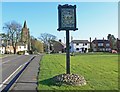
Area Overview for Bitteswell
Photos of Bitteswell
Area Information
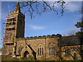
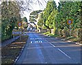
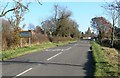
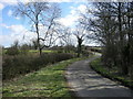
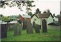
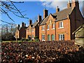
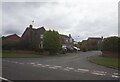
Bitteswell is a compact built-up area in England, spanning 23.2 hectares. It is a small town or city characterised by a mature population, with a median age of 70, suggesting a community of long-term residents. The area’s size means it is likely to feel close-knit, with limited sprawl. Home ownership is high, at 84%, indicating a stable residential base. Living in Bitteswell offers proximity to essential services, including a primary school with a good Ofsted rating and nearby retail outlets. The area’s appeal lies in its balance of safety, with a low crime risk, and practical amenities. While the data does not specify the exact nature of the built environment, the high home ownership rate suggests a mix of residential properties. For those seeking a quieter, established community with access to local facilities, Bitteswell provides a foundation of stability. The presence of a well-regarded primary school adds to its appeal for families.
- Area Type
- Built Up Area 250
- Area Size
- 23.2 hectares
- Population
- Not available
- Population Density
- Not available
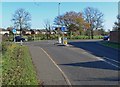
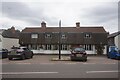
Bitteswell’s lifestyle is shaped by its proximity to practical amenities, including five retail outlets. Notable venues include Co-op Linden, Spar, and Morrisons Lutterworth, which together offer a range of shopping options for daily needs. These stores likely provide groceries, household items, and convenience services, supporting a self-contained lifestyle. The area’s small size means these amenities are within walking or short driving distance, reducing the need for long commutes. While parks or leisure facilities are not mentioned in the data, the presence of retail and educational services suggests a functional, community-focused environment. The combination of local shops and a primary school contributes to a convenient, accessible daily life, particularly for those prioritising proximity to essentials.
Amenities
Schools
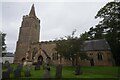
The nearest school to Bitteswell is St Mary’s Church of England Primary School, listed twice in the data with a “good” Ofsted rating. This suggests a single primary school serving the area, which may be the primary educational option for local children. The school’s rating indicates it meets acceptable standards, though no further details on curriculum, size, or facilities are provided. For families, this means a single primary school is available, which may be sufficient for younger children but could limit choices for older students. The absence of secondary schools or other educational institutions in the data means parents may need to consider commuting for higher education. The school’s presence, however, is a positive factor for families prioritising local schooling.
| Rank | School | Type | Entry gender | Ages |
|---|
Explore more schools in this area
Go to Schools tabDemographics
Bitteswell’s population has a median age of 70, which is notably high compared to national averages, indicating a community skewed towards older adults. The most common age range is listed as “Age: Total,” suggesting aggregated data without further breakdown. Home ownership is strong, at 84%, reflecting a predominantly owner-occupied area. However, the data does not specify household composition, accommodation types, or ethnic diversity, so these aspects remain unexplored. The high home ownership rate may imply a long-term resident base, potentially influencing the area’s character. For quality of life, the absence of detailed demographic data means assumptions about diversity or younger families cannot be made. The community’s profile is defined by age and property ownership, with no explicit mention of deprivation levels or socioeconomic variation.
Household Size
Accommodation Type
Tenure
Ethnic Group
Religion
Household Composition
Age
Household Deprivation
NS-SEC
Explore more demographic insights in this area
Go to Demographics tabPlanning
Planning Constraints
- Crime RiskPremium