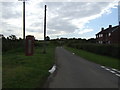
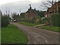
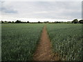
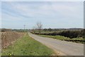
Area Overview for Bitchfield and Bassingthorpe
Photos of Bitchfield and Bassingthorpe
Area Information
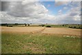
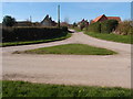
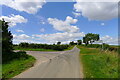
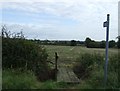
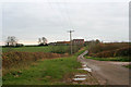
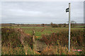
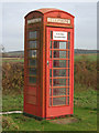
Bitchfield and Bassingthorpe is a civil parish covering an area of 12.8 square kilometres in England. Living here means residing within a defined rural community where the physical boundaries are clear and the setting is established. The parish combines the settlements of Bitchfield and Bassingthorpe into a single administrative unit for local governance. You will find yourself in a location that functions as a traditional parish rather than a sprawling urban extension. Daily life here revolves around the specific characteristics of this civil parish, which lacks the density of major towns but offers a recognised local identity. The area provides a distinct environment for those seeking a life detached from the fastest-paced cities. You settle into a space where the character is defined by its parish status and geographical limits. This compact footprint ensures that the community remains relatively tight-knit and manageable. Prospective buyers looking for homes in Bitchfield and Bassingthorpe enter an area with a clear, established footprint. The locality presents itself as a specific, bounded environment where residents know their surroundings. You navigate a landscape that prioritises local governance and community structure over rapid urban expansion. The parish form gives the area a consistent identity that residents recognise and maintain. This specific categorisation helps define the rules and rhythms of daily living for everyone involved.
- Area Type
- Parish
- Area Size
- 12.8 km²
- Population
- Not available
- Population Density
- Not available
Demographics
The community character in Bitchfield and Bassingthorpe is dominated by an older population, with a median age of 70 years. This figure indicates that the most common age range for residents aligns with retirement and retirement-age living. You should expect to interact with neighbours who are likely retirees or elderly couples rather than young families. More than two-thirds of households, specifically 67 percent, own their homes outright or with a mortgage. This high level of home ownership suggests a settled population with significant ties to the locality. Accommodation types in the parish reflect this demographic reality, favouring detached or semi-detached properties typical of older communities. The household composition data confirms that the area has moved away from multi-generational or young professional living. You will find a residential pattern where stability and long-term residence are the norm. The absence of data on specific ethnic groups or religious affiliations does not change the observable dominance of the older demographic. Deprivation levels are not provided in the available figures, so the focus remains on the clear age and ownership metrics. Living here means participating in a community where the average resident is well into their later years. This specific age profile shapes local services, social clubs, and the general pace of neighbourhood life.
Household Size
Accommodation Type
Tenure
Ethnic Group
Religion
Household Composition
Age
Household Deprivation
NS-SEC
Explore more demographic insights in this area
Go to Demographics tabPlanning
Planning Constraints
- Flood RiskPremium
- Ramsar Wetland SitesPremium
- Area of Outstanding Natural BeautyPremium
- Protected Nature ReservePremium
- Protected WoodlandPremium
- Crime RiskPremium