Area Overview for Birstall West Ward
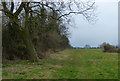
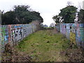
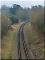
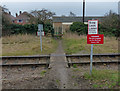
Photos of Birstall West Ward
Area Information
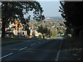
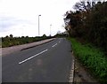
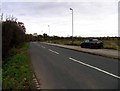
Birstall West Ward is a compact district within Leeds that covers just 2.0 km². This small footprint creates a tightly knit neighbourhood where daily life revolves around familiar local routes. You will find this area dominates a specific part of the Brompton electoral division. The low land area often means a concentrated community feel where services are within easy walking or driving distance. Residents here experience a distinct lifestyle shaped by the ward's limited physical size compared to broader suburban estates. Living in Birstall West Ward offers straightforward access to nearby amenities within the larger Birstall area. The defined boundaries ensure that your daily journey to local shops or leisure spots remains short. This ward provides a focused residential environment suited to those who prefer a settled routine over sprawling suburban commutes. The scale of the area suggests a high density of housing relative to its small geographical extent. You will appreciate that Birstall West Ward stands as a distinct administrative unit with its own characteristics. The community here is established and stable. The small size of the ward contributes to a coherent local identity. Prospective buyers look at this location for its established nature and clear boundaries. You will notice that life in Birstall West Ward is defined by practicality and proximity. The area functions as a self-contained residential zone within the wider West Leeds context. Its distinct borders make it easy to identify on any map of the council area.
- Area Type
- District Borough Unitary Ward
- Area Size
- 2.0 km²
- Population
- Not available
- Population Density
- Not available
Demographics
The population profile of Birstall West Ward reveals a senior-focused community. The median age of 70 indicates that this is primarily an area for retirees and older adults. You will find households here are occupied by people who have already completed building their families and careers. This age structure suggests a quiet atmosphere where the energy level is typically lower than in younger suburbs. The demographic data points to a community where neighbours have known each other for decades. Home ownership stands at 89% within this ward. This figure confirms that the vast majority of residents own their properties outright or have significant equity. Such high ownership rates usually correlate with long-term stability and a settled population. You are more likely to find families or individuals who have lived in their homes for many years than short-term renters. The accommodation type data supports a picture of established residential blocks. The demographic composition reflects a mature population. Those living in Birstall West Ward have shown a preference for buying homes rather than renting. This trend often creates a more predictable neighbourhood environment with consistent housing maintenance. The age range dominates the total population data, shaping local demand for services and amenities. Higher home ownership percentages generally mean residents are less likely to be displaced by the housing market fluctuations. Living here means joining a community of established homeowners.
Household Size
Accommodation Type
Tenure
Ethnic Group
Religion
Household Composition
Age
Household Deprivation
NS-SEC
Explore more demographic insights in this area
Go to Demographics tabPlanning
Planning Constraints
- Flood RiskLocked
- Ramsar Wetland SitesLocked
- Area of Outstanding Natural BeautyLocked
- Protected Nature ReserveLocked
- Protected WoodlandLocked
- Crime RiskLocked