Area Overview for Birstall East & Wanlip Ward
Photos of Birstall East & Wanlip Ward

Area Information
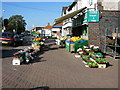
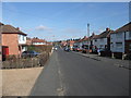
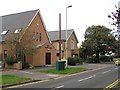
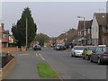
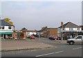
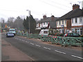
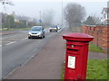
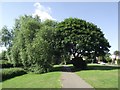
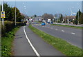
Birstall East & Wanlip Ward is an electoral ward within Charnwood Borough Council that encompasses the eastern part of Birstall village and the adjacent small village of Wanlip. The area covers a total land area of 3.1 square kilometres, situated three miles north of Leicester city centre. This ward represents a unique split within a larger civil parish, merging distinct communities while sharing a historical link to the former Birstall Hall grounds. The name Birstall originates from the Domesday Book entry Burstalle, indicating a Saxon settlement built on a fortification site. Residents find themselves living in an area with deep historical roots. Key landmarks include the Church of St James the Great in Birstall, which dates back to the Early English period with probable Saxon origins. Nearby, Our Lady & St Nicholas in Wanlip was built in 1393 and features a notable gravestone for Rasselas Morjan, an Abyssinian former slave who died there in 1839. The symbolic cedar tree on Roman Road and the Birstall Golf Club, founded in 1901, offer additional character to the neighbourhood. You will be living on the A6, which serves as the last major settlement before Leicester from the north, near the A46. This location places you close to the Great Central Railway route history while providing access to the wider South Coast corridor.
- Area Type
- District Borough Unitary Ward
- Area Size
- 3.1 km²
- Population
- Not available
- Population Density
- Not available
Demographics
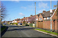
The community within Birstall East & Wanlip Ward is distinctly mature, with a median age of 70 years. This demographic shift defines the neighbourhood, meaning the average resident is significantly older than the national average. The ward functions primarily as a retirement or mature-living zone rather than a area filled with families or young professionals. You are moving into a location where the population profile leans heavily towards senior citizens, which impacts everything from local services to the general pace of daily life. Home ownership is exceptionally high in this ward, with 81% of residents owning their properties outright or with a mortgage. This statistic indicates a neighbourhood that has been settled for generations rather than a changing landscape of short-term renters. The remaining 19% of households likely consist of the 29% who do not own their homes, though the dominance of owner-occupiers suggests stability. The area does not have specific data regarding the predominant ethnic group or religious breakdown in the provided records, but the high ownership rate and age profile suggest a traditional, established community. For you, this means a stable environment where long-term residents have deep roots in villages like Wanlip and Birstall. The household composition reflects this older average, creating a quiet, settled atmosphere typical of areas with such a high percentage of elderly homeowners.
Household Size
Accommodation Type
Tenure
Ethnic Group
Religion
Household Composition
Age
Household Deprivation
NS-SEC
Explore more demographic insights in this area
Go to Demographics tabPlanning
Planning Constraints
- Flood RiskPremium
- Ramsar Wetland SitesPremium
- Area of Outstanding Natural BeautyPremium
- Protected Nature ReservePremium
- Protected WoodlandPremium
- Crime RiskPremium