Area Overview for Birstall
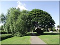
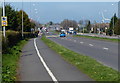
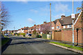
Photos of Birstall

Area Information
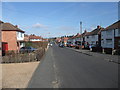
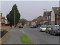
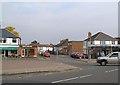
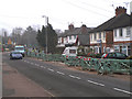
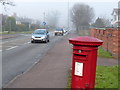
Birstall is a built-up area situated in the English Midlands, covering a total size of 3.2 km². You will find that this location functions as a solid residential community where practicality defines daily life. The area accommodates a mix of housing styles typical of established towns, providing a compact setting for a close-knit population. Residents here enjoy a settled atmosphere without the sprawling distances common in larger cities. This environment suits those who prefer a focused neighbourhood over expansive urban sprawl. The physical footprint of the area ensures that key services and transport links remain within easy reach. Living in Birstall involves navigating a landscape designed for convenience rather than grandeur. You can walk or drive short distances to access local shops and transport hubs. The community feels grounded, reflecting the practical needs of its inhabitants. Prospective buyers should appreciate the straightforward nature of life here. There are no pretensions to hidden attractions waiting to be discovered. Instead, the area offers reliable access to necessities and a stable environment for raising a family. This distinction separates Birstall from more manicured districts further upmarket. It is a place where daily routines take priority over leisurely exploration of unfamiliar precincts.
- Area Type
- Built Up Area 250
- Area Size
- 3.2 km²
- Population
- Not available
- Population Density
- Not available
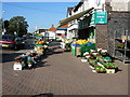
Residents of Birstall enjoy immediate access to a variety of shopping and leisure venues within practical reach. The retail landscape includes Tesco Birstall, Co-op Wanlip, and Waitrose Little, providing plenty of options for daily shopping. With five key retail outlets nearby, you can stock up on groceries and essentials without venturing far. For those interested in leisure or history, the area features three notable metro and rail amenities including the Great Central Railway. This heritage attraction offers a unique cultural experience close to your home. Sileby Railway Station provides another transport option alongside Leicester North and Rothley for journey planning. If you prefer walking or cycling, the proximity of these stations means you can incorporate travel into your weekly routine easily. The combination of modern supermarkets and heritage railways creates a diverse lifestyle offering. Waitrose Little suggests a selection of international products, while Co-op and Tesco handle local necessities. This blend ensures that your daily errands are convenient and varied. You do not need to travel into larger cities for basic provisioning or light entertainment.
Amenities
Schools
Families living in Birstall have access to several educational institutions within the immediate vicinity. Riverside Community Primary School Birstall serves as a primary option within the community. Another local choice is Highcliffe Primary School and Community Centre, which combines education with community activities for young pupils. The Stonehill High School is also listed among the primary institutions available to residents in this catchment. For older children or those with special educational needs, Longslade Community College operates in the surrounding area. Additionally, ALP Leicester holds a good Ofsted rating, offering specialist education options nearby. This mixture of primary colleges and specialist units provides a range of settings for different learning needs. You do not need to travel far to secure a place for your child, as these schools are clustered in practical reach. The presence of a well-rated special school like ALP Leicester is a notable asset for families with diverse educational requirements. This mix ensures that you can reference actual school names without relying on distant centres outside the local borough.
| Rank | School | Type | Entry gender | Ages |
|---|
Explore more schools in this area
Go to Schools tabDemographics
The community profile of Birstall reveals a mature demographic structure distinct from younger urban centres. A median age of 70 years characterises the population, indicating a settlement with a significant number of older residents. This age profile suggests a neighbourhood where stability and long-term residency are common themes. You will encounter a community deeply rooted in the locality, with generations often residing in the same properties. The home ownership rate stands at 73%, confirming that the majority of residents are owners rather than renters. This high level of ownership aligns with the older demographic average, as property investment often accumulates over decades. Household composition reflects this stability, with single-person homes and empty nesters likely forming a sizable portion of the total. Accommodation types vary across the 3.2 km², catering to these established needs. While specific ethnic or religious data is not detailed in available records, the dominant trend points toward a settled, long-standing community structure. Deprivation indices are not explicitly broken down for this specific area in current records, though the high ownership rate usually correlates with a stable economic foundation. Families moving here should note the age skew when considering local group dynamics or youth facilities.
Household Size
Accommodation Type
Tenure
Ethnic Group
Religion
Household Composition
Age
Household Deprivation
NS-SEC
Explore more demographic insights in this area
Go to Demographics tabPlanning
Planning Constraints
- Crime RiskPremium