Area Overview for Billesdon & Tilton Ward
Photos of Billesdon & Tilton Ward
Area Information
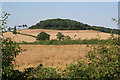
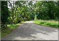
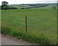
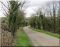
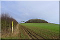
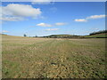
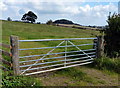
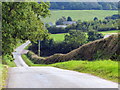
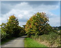
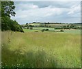
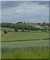
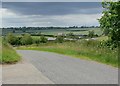
Living in Billesdon & Tilton Ward offers a distinctly rural experience within Leicestershire. The ward covers a substantial 91.1 square kilometres, providing ample space for open countryside and a low-density lifestyle. This area is not defined by high-density urban sprawl but rather by its quiet character and connection to the surrounding rural landscape. You will find homes here in a setting that prioritises privacy and space over the convenience of city-centre commuting. The sheer size of the ward means daily life often revolves around local amenities rather than major retail parks or central town hubs. The demographic profile suggests a community established over decades rather than one in rapid flux, with a population centre tending towards older residents. This stability creates a predictable environment where long-term settlement is common. However, the scale of the area also means services are necessarily more localised. If you require specific healthcare facilities or specialist shopping, you will likely need to travel beyond the ward boundaries. The charm of living in Billesdon & Tilton Ward lies in this self-reliance and the peace that comes with a low-pressure environment. Prospective residents should consider whether their lifestyle aligns with a quieter pace, as the infrastructure simply does not support the density found in larger urban conurbations.
- Area Type
- District Borough Unitary Ward
- Area Size
- 91.1 km²
- Population
- Not available
- Population Density
- Not available
Demographics
The community in Billesdon & Tilton Ward is defined by an older population profile, with a median age of 70 years. This statistic indicates that the majority of residents fall into the senior demographic, which shapes the local culture and available lifestyle options. Age ranges skew heavily towards this older grouping, meaning the area is not a prime destination for young families or students. The reliance on adult children or care services may be greater here than in younger, faster-growing areas. Home ownership stands at 81% within the ward, signalling a deeply rooted, settled community. This high figure suggests that very few people rent their primary residences, and most families have stayed in their homes for extended periods. Accommodation types generally reflect settled families or individuals living alone, rather than transient rental populations. As for diversity, the provided figures do not specify the predominant ethnic group or religious makeup, suggesting a homogenous population likely reflective of the region's historical settlement patterns. This lack of demographic turnover contributes to a steady, unchanging community feel where residents know their neighbours well. The area remains largely consistent with itself, without the influx of new resident groups that characterises expanding urban districts.
Household Size
Accommodation Type
Tenure
Ethnic Group
Religion
Household Composition
Age
Household Deprivation
NS-SEC
Explore more demographic insights in this area
Go to Demographics tabPlanning
Planning Constraints
- Flood RiskPremium
- Ramsar Wetland SitesPremium
- Area of Outstanding Natural BeautyPremium
- Protected Nature ReservePremium
- Protected WoodlandPremium
- Crime RiskPremium