Area Overview for Billesdon
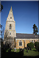
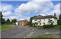
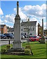
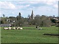
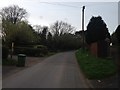
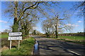
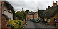
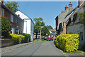
Photos of Billesdon
Area Information
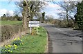
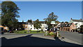
Billesdon is a compact built-up area in England, covering 39 hectares. It is a small but functional community, with a median age of 70, suggesting a population skewed towards older residents. The area is not densely populated, offering a quiet, low-density living environment. For those considering homes in Billesdon, the 74% home ownership rate indicates a stable community where most residents own their properties. Nearby, Billesdon Church of England Primary School provides education for young families, though its Ofsted rating is satisfactory rather than outstanding. The area’s proximity to Leicester Airport and local retail outlets like Co-op Houghton and Spar adds practical convenience. While the broadband score is low, mobile coverage is strong, supporting connectivity for daily use. Billesdon is not a bustling urban hub, but its simplicity and accessibility make it a viable choice for those prioritising tranquillity and ease of access to regional amenities.
- Area Type
- Built Up Area 250
- Area Size
- 39.0 hectares
- Population
- Not available
- Population Density
- Not available
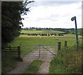
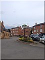
Billesdon’s lifestyle is shaped by its proximity to practical amenities. Local shops such as Co-op Houghton, Co-op Thurnby, and Spar provide everyday essentials, though the range is limited compared to larger towns. The Leicester Airport offers regional travel access, which could be useful for business or leisure trips. The absence of parks or recreational facilities in the data suggests that outdoor leisure may require travel to nearby areas. For residents valuing convenience, the local retail options and airport are assets, but the lack of green spaces or cultural venues may be a drawback for those seeking a more vibrant lifestyle. The area’s character is defined by simplicity and accessibility to essential services.
Amenities
Schools
The nearest school to Billesdon is Billesdon Church of England Primary School, which serves the local community with primary education. Its Ofsted rating is satisfactory, meaning it meets basic standards but lacks outstanding performance. The absence of secondary schools or other educational institutions in the data means families may need to look beyond Billesdon for comprehensive schooling. This single school suggests limited options for parents seeking a range of educational environments, though the primary school’s presence ensures basic educational needs are met. For buyers prioritising schools, the satisfactory rating may be a consideration, but the lack of additional schools could influence decisions about long-term family needs.
| Rank | School | Type | Entry gender | Ages |
|---|
Explore more schools in this area
Go to Schools tabDemographics
Billesdon’s population has a median age of 70, the highest in the dataset, indicating a community dominated by older adults. This age profile suggests a demographic with established routines and limited demand for childcare facilities. The 74% home ownership rate reflects a stable, long-term resident base, though the data does not specify household composition or diversity. The lack of detailed information on accommodation types or ethnic groups means the area’s social fabric remains opaque. However, the absence of deprivation data implies that basic needs are met, though the high median age may influence local services and infrastructure needs. For buyers, this demographic profile suggests a community with a focus on retirement living and limited turnover in the property market.
Household Size
Accommodation Type
Tenure
Ethnic Group
Religion
Household Composition
Age
Household Deprivation
NS-SEC
Explore more demographic insights in this area
Go to Demographics tabPlanning
Planning Constraints
- Crime RiskPremium