Area Overview for Belper North Ward
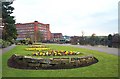
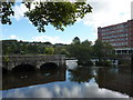
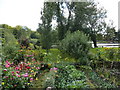
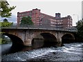
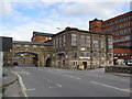
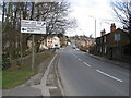
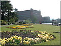
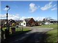
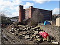
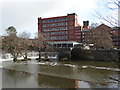
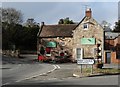
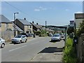
Photos of Belper North Ward
Area Information
Belper North Ward sits approximately seven miles north of Derby on the River Derwent. It forms a parish ward within the wider civil parish of Belper, located in the Amber Valley district of Derbyshire. This district borough unitary ward covers an area of 7.8 km² and serves as a substantial residential sector within Mid Derbyshire. The location offers proximity to notable local hills such as Hillside, which reaches 214 metres, while the western boundary approaches Wyver. Residents benefit from access to the River Derwent and views over the surrounding landscape. The ward comprises several distinct settlements, including the main town area alongside hamlets like Bargate, Blackbrook, and Makeney. Living in Belper North Ward means experiencing a community deeply connected to its historical roots. Records indicate the area was once part of the Forest of East Derbyshire before becoming part of Duffield Frith in the 13th century. The Belper constituency, which represented this locality until 1983, had a significant political history, being held by George Brown from 1945 to 1970. Today, the ward provides a settled environment where daily life revolves around local amenities and the natural features that define the Derbyshire countryside. The A6 motorway runs parallel to the river, offering a major through-road connection for those commuting to larger city centres or travelling further afield. This established settlement pattern makes Belper North Ward a reliable choice for those seeking a location with deep regional significance.
- Area Type
- District Borough Unitary Ward
- Area Size
- 7.8 km²
- Population
- Not available
- Population Density
- Not available
Demographics
The community character of Belper North Ward is defined by a notably older population profile. The median age of residents is 70 years, indicating that the ward attracts a demographic with a high proportion of retirees or long-term settled families. While specific age breakdowns beyond the median are not available, this high figure suggests a quiet residential atmosphere rather than a bustling hub for young professionals or students. Homeownership is the prevailing tenure method, with 76% of properties occupied by their owners. This level of ownership implies a stable neighbourhood where residents have long-term ties to the locality. Household composition and ethnic diversity data are not explicitly detailed in the provided figures, but the high ownership rate underscores a traditional community structure. The population density within the 7.8 km² area supports a low-rise living environment typical of suburban or semi-rural wards in Derbyshire. For those considering homes in Belper North Ward, the demographic profile suggests a mature environment with established routines. The absence of younger age groups in the core statistics points towards a retirement-focused settlement pattern. Prospective buyers should note that a median age of 70 may enhance available facilities geared towards older adults while potentially reducing evening vibrancy. The stable ownership figure of 76% confirms that the ward is not primarily a student rental zone or transient area.
Household Size
Accommodation Type
Tenure
Ethnic Group
Religion
Household Composition
Age
Household Deprivation
NS-SEC
Explore more demographic insights in this area
Go to Demographics tabPlanning
Planning Constraints
- Flood RiskPremium
- Ramsar Wetland SitesPremium
- Area of Outstanding Natural BeautyPremium
- Protected Nature ReservePremium
- Crime RiskPremium