Area Overview for Belleau
Photos of Belleau

Area Information
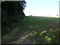
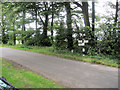
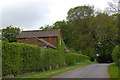
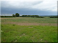
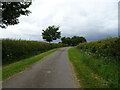
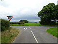
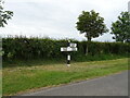
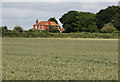
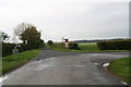
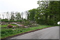
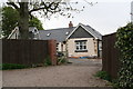
You are looking at a small civil parish covering just 2.9 km², a compact space where daily life revolves around a close-knit rural setting. Belleau presents itself as a quiet retreat rather than a bustling hub, suitable for those who prioritise simplicity over urban convenience. The area is defined by its manageable size, which fosters an environment where residents know one another. Living in Belleau means accepting a lifestyle centred on local resources rather than extensive transport networks. The parish status indicates a level of local governance distinct from larger towns, focusing on maintaining community standards. Prospective homebuyers should expect a peaceful existence where the pace of life is slow. This demographic profile suggests a community built on tradition and stability. You will find a setting where the focus remains on residential comfort and nearby natural features. The area does not offer the amenities of a city centre but provides a sanctuary for those seeking stillness. ### The community in Belleau is dominated by older generations, with a median age of exactly 70 years. This figure indicates that you are likely to encounter a settlement where retirement living is common. The most common age range aligns with this senior demographic, meaning families with young children may not find this parish their ideal home. Home ownership stands at 81%, a stark statistic that confirms this is a quiet, settled community where residents have established long-term roots. This high rate of ownership contrasts sharply with modern rental-heavy markets, suggesting stability in your future neighbours. Household composition and accommodation types reflect this older population structure, likely comprising single occupants, widows, or couples living together. Religious composition and predominant ethnicity are recorded as totals in the available surveys, reflecting a standard reporting metric for the parish. You can expect a society that values independence and quiet company. The low turnover rate implied by these figures ensures you will be dealing with established residents rather than transient populations seeking short-term leases. ### The housing landscape in Belleau is almost entirely owner-occupied, with 81% of residents owning their homes outright or with a mortgage. This market dynamic creates an area where property transactions occur less frequently than in high-turnover rental districts. You will find a stable housing stock where long-term maintenance reflects owner pride rather than landlord oversight. Accommodation types within the parish mirror this ownership trend, favouring permanent residences over temporary lets. This concentration of home ownership suggests that the built environment caters to older buyers or those seeking a final base. If you are looking to purchase a home in Belleau, you should anticipate a market with fewer immediate listings compared to larger towns. The lack of a significant rental sector indicates that stock is not constantly circulating for investment purposes. Buyers here are typically individuals seeking peace and permanence rather than landlords chasing yield. This environment supports a calm residential atmosphere where neighbours care deeply for their immediate surroundings. ### Digital connectivity plays a vital role for any homebuyer considering working from home while living in Belleau. Mobile network quality scores 82 out of 100, categorised as good coverage. This rating ensures that your communications remain reliable during walks across the parish or while driving through the rural lanes. For residents relying on video calls or cloud-based work applications, this connectivity level provides sufficient bandwidth for daily tasks. Broadband infrastructure supports the local economy by ensuring seamless internet access for households. You can rely on stable connection speeds for streaming, banking, and remote employment without significant service interruptions. This standard of connectivity is essential for maintaining a functional lifestyle in a location where physical shops may be scarce. The mobile signal strength means you are not isolated technologically despite the rural setting. Digital accessibility in Belleau meets the needs of modern working professionals who require consistent online presence without venturing far from their homes. ### Safety and environmental factors in Belleau present a mixed picture that requires careful consideration for potential residents. The area boasts a low crime risk score of 83, placing it firmly in the safe category with below-average crime rates. This high safety rating suggests you can move through the parish with confidence and security. A genuine environmental concern involves flood risk, which carries a warning level score of 11.77. This indicates a medium risk that could impact properties near water or low-lying sections of the land. Planning constraints further influence development possibilities. The parish sits within an Area of Outstanding Natural Beauty, scoring 33.24, which means strict rules govern any new construction. Additionally, protected woodland covers a small portion of the land, contributing to the score of 1.91. These green designations preserve natural beauty but limit planning freedom. Ramsar wetland sites are absent, scoring zero, which removes one specific planning hurdle from the equation. You must weigh the tranquil safety against these environmental restrictions before finalising any purchase plans. ### Who typically lives in Belleau and what is the community feel like?The community is defined by its senior demographic, with a median age of 70. This creates a quiet, established neighbourhood where 81% of homes are owner-occupied. You will find a stable population rather than families with young children, making it ideal for retirees or those seeking a peaceful retirement. How is transport and digital connectivity in Belleau for remote workers?Digital infrastructure is robust, with mobile coverage scoring 82 out of 100, rated as good. This reliable connection supports remote work and daily digital tasks without interruption. While the area is rural, the connectivity ensures you remain connected to the wider internet world effectively. What are the safety and environmental risks for buying property in Belleau?Crime risk is low with a safety score of 83. However, environmental risks include medium flood threat (score 11.77) and restrictions due to Area of Outstanding Natural Beauty status and protected woodland. These factors limit development but preserve the area's natural character.
- Area Type
- Parish
- Area Size
- 2.9 km²
- Population
- Not available
- Population Density
- Not available
Demographics
The community in Belleau is dominated by older generations, with a median age of exactly 70 years. This figure indicates that you are likely to encounter a settlement where retirement living is common. The most common age range aligns with this senior demographic, meaning families with young children may not find this parish their ideal home. Home ownership stands at 81%, a stark statistic that confirms this is a quiet, settled community where residents have established long-term roots. This high rate of ownership contrasts sharply with modern rental-heavy markets, suggesting stability in your future neighbours. Household composition and accommodation types reflect this older population structure, likely comprising single occupants, widows, or couples living together. Religious composition and predominant ethnicity are recorded as totals in the available surveys, reflecting a standard reporting metric for the parish. You can expect a society that values independence and quiet company. The low turnover rate implied by these figures ensures you will be dealing with established residents rather than transient populations seeking short-term leases. ### The housing landscape in Belleau is almost entirely owner-occupied, with 81% of residents owning their homes outright or with a mortgage. This market dynamic creates an area where property transactions occur less frequently than in high-turnover rental districts. You will find a stable housing stock where long-term maintenance reflects owner pride rather than landlord oversight. Accommodation types within the parish mirror this ownership trend, favouring permanent residences over temporary lets. This concentration of home ownership suggests that the built environment caters to older buyers or those seeking a final base. If you are looking to purchase a home in Belleau, you should anticipate a market with fewer immediate listings compared to larger towns. The lack of a significant rental sector indicates that stock is not constantly circulating for investment purposes. Buyers here are typically individuals seeking peace and permanence rather than landlords chasing yield. This environment supports a calm residential atmosphere where neighbours care deeply for their immediate surroundings. ### Digital connectivity plays a vital role for any homebuyer considering working from home while living in Belleau. Mobile network quality scores 82 out of 100, categorised as good coverage. This rating ensures that your communications remain reliable during walks across the parish or while driving through the rural lanes. For residents relying on video calls or cloud-based work applications, this connectivity level provides sufficient bandwidth for daily tasks. Broadband infrastructure supports the local economy by ensuring seamless internet access for households. You can rely on stable connection speeds for streaming, banking, and remote employment without significant service interruptions. This standard of connectivity is essential for maintaining a functional lifestyle in a location where physical shops may be scarce. The mobile signal strength means you are not isolated technologically despite the rural setting. Digital accessibility in Belleau meets the needs of modern working professionals who require consistent online presence without venturing far from their homes. ### Safety and environmental factors in Belleau present a mixed picture that requires careful consideration for potential residents. The area boasts a low crime risk score of 83, placing it firmly in the safe category with below-average crime rates. This high safety rating suggests you can move through the parish with confidence and security. A genuine environmental concern involves flood risk, which carries a warning level score of 11.77. This indicates a medium risk that could impact properties near water or low-lying sections of the land. Planning constraints further influence development possibilities. The parish sits within an Area of Outstanding Natural Beauty, scoring 33.24, which means strict rules govern any new construction. Additionally, protected woodland covers a small portion of the land, contributing to the score of 1.91. These green designations preserve natural beauty but limit planning freedom. Ramsar wetland sites are absent, scoring zero, which removes one specific planning hurdle from the equation. You must weigh the tranquil safety against these environmental restrictions before finalising any purchase plans. ### Who typically lives in Belleau and what is the community feel like?The community is defined by its senior demographic, with a median age of 70. This creates a quiet, established neighbourhood where 81% of homes are owner-occupied. You will find a stable population rather than families with young children, making it ideal for retirees or those seeking a peaceful retirement. How is transport and digital connectivity in Belleau for remote workers?Digital infrastructure is robust, with mobile coverage scoring 82 out of 100, rated as good. This reliable connection supports remote work and daily digital tasks without interruption. While the area is rural, the connectivity ensures you remain connected to the wider internet world effectively. What are the safety and environmental risks for buying property in Belleau?Crime risk is low with a safety score of 83. However, environmental risks include medium flood threat (score 11.77) and restrictions due to Area of Outstanding Natural Beauty status and protected woodland. These factors limit development but preserve the area's natural character.
Household Size
Accommodation Type
Tenure
Ethnic Group
Religion
Household Composition
Age
Household Deprivation
NS-SEC
Explore more demographic insights in this area
Go to Demographics tabPlanning
Planning Constraints
- Flood RiskPremium
- Ramsar Wetland SitesPremium
- Area of Outstanding Natural BeautyPremium
- Protected Nature ReservePremium
- Protected WoodlandPremium