Area Overview for Beeston West Ward
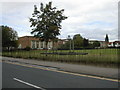
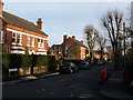
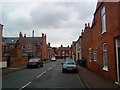
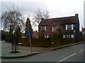
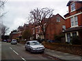
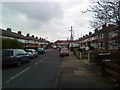
Photos of Beeston West Ward
Area Information
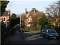
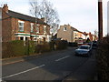
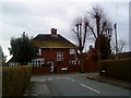
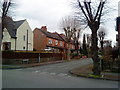
Beeston West Ward occupies a distinct 1.1 km² space within the district borough unitary structure of Beeston. This compact area serves as a well-defined residential zone where daily life moves at a considered pace. You will find yourself surrounded by a community where over two-thirds of residents own their homes, creating a settlement with deep local roots. The ward is characterised by low flood risk, offering peace of mind for anyone considering living in Beeston West Ward without the uncertainty of water-related incidents. There are no planning constraints related to protected nature reserves, Ramsar wetland sites, or areas of outstanding natural beauty within these boundaries. This allows for a straightforward living environment devoid of significant regulatory overlays that might complicate local development or maintenance. The area functions as a practical, functional neighbourhood rather than a rural escape or a high-density urban centre. Your days here will be shaped by stable surroundings and a clear understanding of the local rules and risks. While crime levels sit at an average mark, you should remain aware that medium risk requires standard security precautions similar to any typical English neighbourhood.
- Area Type
- District Borough Unitary Ward
- Area Size
- 1.1 km²
- Population
- Not available
- Population Density
- Not available
Demographics
The community profile in Beeston West Ward reflects an older demographic settlement. The median age across the ward stands at 70, indicating a population where residents have likely settled in their final decades of life. You are entering a neighbourhood where the most common age group encompasses older adults rather than young families or recent graduates. With home ownership reaching 65 per cent of the total population, the social fabric is built on property stability. This high rate suggests that fewer people are renting short-term and more are deeply embedded in the local identity. The ward contains no specific data on predominant ethnic groups or religious breakdown, so the demographic narrative relies heavily on age and tenure. You will find a community that values established routines and long-term residency over rapid turnover. This profile often correlates with quieter streets and a slower pace of community engagement compared to younger, flatter wards. When you choose living in Beeston West Ward, you join a cohort of neighbours who have built their lives around this specific postcode area. The lack of younger demographic data means you should look for community groups specifically focused on senior interests or retirement activities.
Household Size
Accommodation Type
Tenure
Ethnic Group
Religion
Household Composition
Age
Household Deprivation
NS-SEC
Explore more demographic insights in this area
Go to Demographics tabPlanning
Planning Constraints
- Flood RiskPremium
- Ramsar Wetland SitesPremium
- Area of Outstanding Natural BeautyPremium
- Protected Nature ReservePremium
- Protected WoodlandPremium