Area Overview for Beeston Rylands Ward
Photos of Beeston Rylands Ward
Area Information
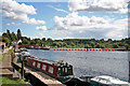
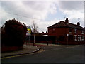
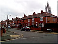
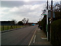
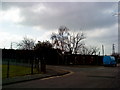
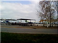
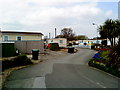
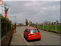
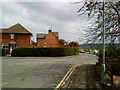
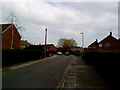
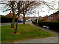
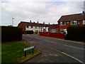
Beeston Rylands Ward sits as a distinct residential district within Beeston, covering an area of 2.4 km². Located roughly 3¼ miles south-west of Nottingham city centre, this ward represents the oldest part of the town's modern expansion, rooted in Victorian development that spread south from the railway line in the late 19th century. The name Rylands originally described a small settlement clustered around Beeston Lock, but it now encompasses the entirety of the area south of the tracks. You will find that the ward is larger than the other three wards within Beeston, offering a significant expanse for housing and local amenities. The landscape includes historic conservation areas and notable buildings such as the Grange, which was saved from demolition in the mid-1970s. The Nottingham and Beeston Canal runs through parts of the area, linking residents to local heritage sites like Beeston Lock. Daily life here involves proximity to the Crown Inn on Middle Street and the historic Beeston Fields Golf Club. The area functions as a well-established neighbourhood where Victorian villas constructed near the level crossing continue to define the streetscape. Living in Beeston Rylands Ward means accessing a location with deep historical roots, including the original St John's Grove Estate established in 1878, all while remaining close to Midland railway network services.
- Area Type
- District Borough Unitary Ward
- Area Size
- 2.4 km²
- Population
- Not available
- Population Density
- Not available
Demographics
The community within Beeston Rylands Ward reflects an older demographic profile compared to the national average. The median age for residents is 70 years, indicating a population skewed significantly towards older adults. This age profile suggests a neighbourhood where many households are retirement-focused or consist of long-term families with older children. Home ownership stands at 62%, meaning that nearly two-thirds of residents on the ward keep their status as owner-occupiers. This high rate of ownership typically correlates with a stable community where residents are invested in the long-term improvement of their properties. The household composition data categorises total households without singling out specific family types, which aligns with an area supporting varied living arrangements from singles to multi-generational families. While specific data on predominant ethnic groups and religious demographics are not broken down in the current report, the historical development of the ward through land societies like the Imperial Park Land Society in 1878 established a established local culture. The absence of constraints such as Ramsar wetland sites or Areas of Outstanding Natural Beauty means planning decisions relate primarily to residential density rather than protected environmental assets. Characteristics of living in Beeston Rylands Ward are defined by this mature population structure and a strong culture of property ownership.
Household Size
Accommodation Type
Tenure
Ethnic Group
Religion
Household Composition
Age
Household Deprivation
NS-SEC
Explore more demographic insights in this area
Go to Demographics tabPlanning
Planning Constraints
- Flood RiskPremium
- Ramsar Wetland SitesPremium
- Area of Outstanding Natural BeautyPremium
- Protected Nature ReservePremium
- Protected WoodlandPremium