Area Overview for Beeley
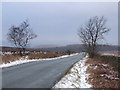
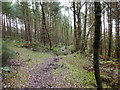
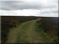
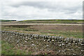
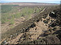
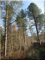
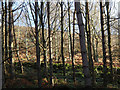
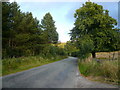
Photos of Beeley


Area Information
Living in Beeley offers a quiet existence within a very small parish that covers just 13.1 km² of land. You will find yourself in a civil parish in England where space is scarce but the setting is undeniably rural. The small geographic footprint means distances between homes and local support services are naturally short, creating a compact community feel. This area does not feature the expansive estates or urban sprawl found in larger towns. Instead, residents navigate a limited landscape defined by its specific boundaries and size. The parish status suggests a focus on local governance and community affairs rather than rapid expansion. Daily life here revolves around the immediate neighbourhood rather than the wider region which lies further away. You should expect a pace of life dictated by the season and the weather given the open nature of the land. The limited area size ensures that there are few major obstacles to traverse if you wish to explore the immediate surroundings. Beeley remains a modest settlement where many residents likely know their neighbours. This constrained environment results in a distinct, insular community atmosphere compared to larger urban centres. Your evening stroll would quickly circle the available grounds without reaching major arterial roads. The essence of Beeley is defined by its simplicity and lack of elaborate development. There are no sections on luxury amenities or massive commercial schemes to populate the space. The area relies on its established character and the people who call this small patch of England home. If you value a environment where every house plot is visible, then the 13.1 km² limit might appeal to you. It is a place where privacy coexists with a strong, if small, sense of community. You are not overlooking a vast horizon but rather a contained rural setting.
- Area Type
- Parish
- Area Size
- 13.1 km²
- Population
- Not available
- Population Density
- Not available
Demographics
The community profile in Beeley is heavily skewed towards older generations. Data indicates a median age of 70, meaning half of all residents are at least this age. This demographic suggests a population retiring from work rather than families relocating for school placements. The most common age range is recorded as Age: Total, reflecting a broad spread centred on this elderly cohort. You will encounter fewer young people or teenagers spending their school holidays in the area compared to more dynamic towns. Home ownership dominates the local housing landscape with a staggering 63% of households owning their property outright or with a mortgage. This high figure confirms that Beeley is primarily an owner-occupied area rather than a rental market for students or young professionals. The accommodation type data is recorded under the category of total, indicating a stable mix of dwelling styles suited to those staying long term. There is no evidence of transient housing or seasonal rentals disrupting the social fabric. Ethnic diversity and religious composition are noted under the predominant ethnic group and religion totals, suggesting a community that may reflect broader national trends but lacks specific breakdowns here. The deprivation context is implied by the age profile; older residents often own assets but may face challenges regarding mobility and healthcare access in a rural setting. Living in Beeley means joining a cohort where pensioners form the majority of social interactions. You will find fewer new migrants or diverse families compared to urban districts. The household composition remains relatively static, mirroring the older median age.
Household Size
Accommodation Type
Tenure
Ethnic Group
Religion
Household Composition
Age
Household Deprivation
NS-SEC
Explore more demographic insights in this area
Go to Demographics tabPlanning
Planning Constraints
- Flood RiskPremium
- Ramsar Wetland SitesPremium
- Area of Outstanding Natural BeautyPremium
- Protected Nature ReservePremium
- Protected WoodlandPremium
- Crime RiskPremium