Area Overview for Bassingfield
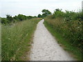
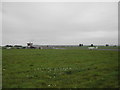
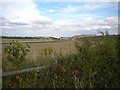
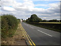
Photos of Bassingfield


Area Information
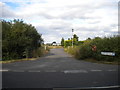
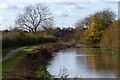
Bassingfield is a compact built-up area in England, spanning 1.7 km². It is a town or city characterised by a mature population, with a median age of 70, suggesting a community of long-term residents. The high home ownership rate of 84% indicates a stable, settled demographic. Living in Bassingfield offers proximity to essential services, including Nottingham Airport, which is just one of the area’s key transport links. The surrounding area includes multiple rail stations and tram stops, such as Radcliffe Railway Station and Wilford Lane Tram Stop, ensuring connectivity to nearby towns. Daily life here is shaped by a mix of practical amenities and a quiet, established atmosphere. The presence of retail outlets like Morrisons West and Sainsburys Cotgrave adds to the convenience for residents. For those considering homes in Bassingfield, the area’s blend of accessibility and a mature community profile makes it a compelling choice for buyers seeking stability and ease of movement.
- Area Type
- Built Up Area 250
- Area Size
- 1.7 km²
- Population
- Not available
- Population Density
- Not available
Residents of Bassingfield have access to a range of amenities within practical reach. The area is near Nottingham Airport, offering easy travel to regional and international destinations. Retail options include Morrisons West, Co-op Hilton, and Sainsburys Cotgrave, providing everyday shopping convenience. Multiple rail stations, such as Carlton and Radcliffe, and tram stops like Compton Acres ensure reliable public transport. These facilities contribute to a lifestyle that balances practicality with accessibility. The presence of nearby amenities reduces the need for long commutes, allowing residents to enjoy local shops, transport links, and leisure options without venturing far. This mix of services supports a self-contained lifestyle, ideal for those prioritising convenience and connectivity in their daily routines.
Amenities
Schools
| Rank | A + A* % | School | Type | Entry gender | Ages |
|---|
Explore more schools in this area
Go to Schools tabDemographics
The population of Bassingfield has a median age of 70, with the most common age range encompassing all demographics. This suggests a community where older residents form a significant proportion. Home ownership is high, at 84%, indicating that most households are owner-occupied rather than renting. The data does not specify household composition or accommodation types, but the overall figures imply a settled population with long-term ties to the area. The lack of detailed information on ethnic diversity or deprivation means the community’s social fabric remains less defined in the data. However, the high home ownership rate suggests a stable environment where residents are likely to have established roots. This profile may appeal to those seeking a quiet, mature neighbourhood with a strong sense of continuity.
Household Size
Accommodation Type
Tenure
Ethnic Group
Religion
Household Composition
Age
Household Deprivation
NS-SEC
Explore more demographic insights in this area
Go to Demographics tabPlanning
Planning Constraints
- Crime RiskLocked