Area Overview for Baslow and Bubnell
Photos of Baslow and Bubnell


Area Information
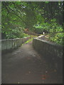
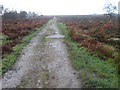
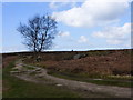
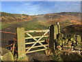
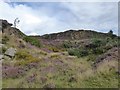
Living in Baslow and Bubnell offers a distinctly rural experience within a civil parish that spans 22.8 square kilometres. This area sits quietly away from the bustle of major urban centres, providing a backdrop of open countryside for anyone seeking tranquillity. The landscape is defined by its large footprint, which allows for significant green spaces and a low population density. You will find a neighbourhood where daily life revolves around local amenities rather than commuter traffic. The environment supports a pace of living that many consider ideal for retirement or a quiet family lifestyle. There are no constraints from protected nature reserves in the traditional sense of Ramsar sites or Areas of Outstanding Natural Beauty, although you must be aware of protected woodland and nature reserves within the boundary. These environmental designations remain a consideration for future planning and building projects. The geography suggests a place where you can enjoy wide-open skies without the shadow of strict development zones. Residents benefit from a setting that feels both expansive and grounded. You are not living in a town centre but in a community with plenty of room to breathe. The area's size ensures that traffic congestion remains a non-issue for most journeys. Your home will likely offer views across open land rather than overlooking busy roads. This spaciousness contributes to a sense of isolation that some residents find refreshing while others might miss a closer proximity to shops. The character of Baslow and Bubnell is defined by this balance between natural beauty and functional simplicity.
- Area Type
- Parish
- Area Size
- 22.8 km²
- Population
- Not available
- Population Density
- Not available
Demographics
The community in Baslow and Bubnell displays a clear demographic profile centred on an older population. The median age of residents is seventy, which indicates that the village caters primarily to retirees or those wishing to settle down later in life. This age distribution influences the types of housing available and the local services in demand. You will encounter neighbours who have likely lived in the area for decades, fostering a stable and established social circle. Home ownership stands at sixty-three per cent, a figure that suggests a long-term commitment to the locality by current residents. This high rate of owner-occupation contrasts with areas where renting dominates, offering a more consistent neighbourhood fabric. The household composition reflects this settled nature, with families and couples forming the core of the social structure. You can expect a quiet environment where neighbours know each other well over time. There is no specific data provided regarding ethnic diversity or religious affiliations in the available records, so the community appears to maintain its traditional British character. The accommodation types align with the needs of an older demographic, focusing on single-family homes rather than high-density living. Deprivation levels are not explicitly quantified in the current dataset, but the lack of younger families often correlates with lower economic pressure rather than poverty. Living in Baslow and Bubnell means accepting a population where life slows down and long-term stability prevails. The demographic makeup ensures that the village feels familiar and predictable to those who choose to buy homes here. You are joining a group of people who have chosen this specific spot for its suitability in later life. This stability creates a strong sense of belonging for newcomers who fit the age profile. The seventy-year median age acts as a definitive marker for who belongs in this village community today.
Household Size
Accommodation Type
Tenure
Ethnic Group
Religion
Household Composition
Age
Household Deprivation
NS-SEC
Explore more demographic insights in this area
Go to Demographics tabPlanning
Planning Constraints
- Flood RiskPremium
- Ramsar Wetland SitesPremium
- Area of Outstanding Natural BeautyPremium
- Protected Nature ReservePremium
- Protected WoodlandPremium