Area Overview for Basford Ward
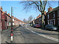
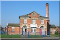
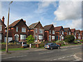
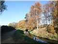
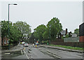
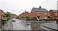
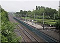
Photos of Basford Ward

Area Information
Living in Basford Ward offers a distinct experience shaped by its compact scale and mature community. This district borough unitary ward spans just 3.6 square kilometres, making it a relatively contained neighbourhood where local shops and services are easily accessible without long commutes. Despite the small footprint, the area supports a population of approximately 2,000 residents, creating a setting that feels lived-in but not overcrowded. You will find density here is moderate, with roughly 559 people per square kilometre. This figure suggests a residential environment where homes are situated closely enough to foster familiarity but with sufficient space to maintain quiet. The ward is located within the city, providing proximity to wider urban amenities while retaining a local character defined by its size and population. Daily life for residents involves navigating a space that balances convenience with a specific suburban atmosphere. There is no data to detail specific landmarks or Edwardian features, yet the area functions as a cohesive unit within the broader local authority. Buyers looking for a defined, walkable district will appreciate how the ward's limited size manages to accommodate nearly two thousand households. The community is established, offering a sense of locality that larger, sprawling parts of the city lack. For those considering homes in Basford Ward, the primary draw is this manageable scale, which supports a predictable rhythm to daily life.
- Area Type
- District Borough Unitary Ward
- Area Size
- 3.6 km²
- Population
- 1999
- Population Density
- 559 people/km²
Demographics
The community within Basford Ward is defined by a clear demographic profile and a significant owner-occupier base. The median age sits at 70, which places this ward well above the national average and signalling a population dominated by retirees or older residents. This age structure influences the local rhythm, suggesting a quieter environment typical of later-life settlement rather than a hub for young professionals or families with small children. Regarding home ownership, 51% of households own their properties outright or with a mortgage. This indicates a strong sentiment of stability among residents, as you are more likely to find people who have settled long-term rather than transient tenants who might move frequently. The data does not provide specific breakdowns for household composition, predominant ethnic groups, religious affiliations, or the exact mix of accommodation types such as semi-detached or terraced houses. However, the overall picture points to an area where long-term residents have established a foothold. With 51% ownership, nearly half of the homes are on the market or held by investors, while the remaining share belongs to renters. For someone moving to Basford Ward, this demographic reality means engaging with a neighbourhood that values stability and permanence over rapid turnover. The high median age suggests that local facilities and social activities are likely tailored to an older demographic, which you might find during your visit.
Household Size
Accommodation Type
Tenure
Ethnic Group
Religion
Household Composition
Age
Household Deprivation
NS-SEC
Explore more demographic insights in this area
Go to Demographics tabPlanning
Planning Constraints
- Flood RiskPremium
- Ramsar Wetland SitesPremium
- Area of Outstanding Natural BeautyPremium
- Protected Nature ReservePremium
- Protected WoodlandPremium
- Crime RiskPremium