Area Overview for Barlow & Holmesfield Ward
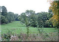
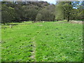
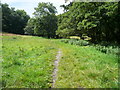
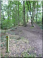
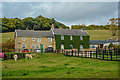
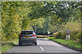
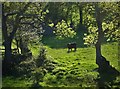
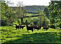
Photos of Barlow & Holmesfield Ward
Area Information
Barlow & Holmesfield Ward serves as a distinct administrative district within North East Derbyshire, covering a geographical area of 39.9 km². The ward is modelled around the village of Barlow, situated at approximately 53.267557°N, 1.4844158°W, and forms part of the larger Barlow CP civil parish. This locality operates under the North East Derbyshire County Constituency, positioning it firmly within the East Midlands region of England. Daily life here reflects a settled, rural existence typical of Derbyshire villages, where the physical layout is defined by specific coordinates like the ward centre at 53.283727°N, 1.537098°W. Residents rely on this established framework for local governance and services. The area offers a defined sense of place, distinct from urban sprawl, yet integrated into the broader local authority infrastructure. Anyone considering homes in Barlow & Holmesfield Ward should view this ward as a complete unit of local life rather than a fragment of a larger city. The environment is grounded in its specific boundaries, offering a consistent identity for those purchasing property or searching for a new address. The ward provides a tangible location for all administrative purposes, ensuring clarity for stakeholders and families choosing this part of the county.
- Area Type
- District Borough Unitary Ward
- Area Size
- 39.9 km²
- Population
- Not available
- Population Density
- Not available
Demographics
The community within Barlow & Holmesfield Ward presents a highly mature demographic profile, with a median age standing at 70 years. This indicates that the population consists primarily of retirees rather than young families or a mixed working-age cohort. The most common age grouping is recorded as 'Total', reflecting the broad spread inherent in an elderly population. Home ownership stands at a remarkably high 76% of households, suggesting that property tenure is predominantly stable and long-term rather than rental-based. This figure tends to rise with age, linking closely to the high median age observed in the ward. Accommodation types and ethnic group data are currently unavailable in the provided records, meaning the specific mix of housing styles or religious demographics cannot be detailed with precision. However, the overall picture points to a quiet, settled environment where residents have established deep roots. The high ownership rate correlates with a community likely to be less transient and more focused on long-term local engagement. Deprivation levels are not explicitly detailed in the current dataset, but the ownership figures generally signal financial security within the housing stock. For homebuyers, this demographic reality means the area appeals strongly to retirees seeking stability.
Household Size
Accommodation Type
Tenure
Ethnic Group
Religion
Household Composition
Age
Household Deprivation
NS-SEC
Explore more demographic insights in this area
Go to Demographics tabPlanning
Planning Constraints
- Flood RiskPremium
- Ramsar Wetland SitesPremium
- Area of Outstanding Natural BeautyPremium
- Protected Nature ReservePremium
- Protected WoodlandPremium
- Crime RiskPremium