Area Overview for Barlow
Photos of Barlow
Area Information
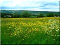
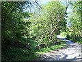
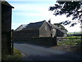
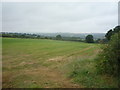
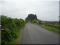
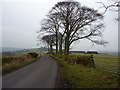
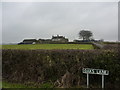
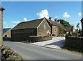
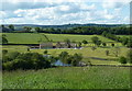
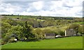
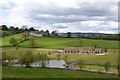
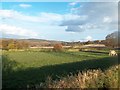
Living in Barlow means settling into a civil parish with a distinct rural character. You will find yourself within a defined boundary covering exactly 15.6 square kilometres. This small geographical footprint suggests a close-knit environment where distances between properties are short. The area sits in England, offering a peaceful setting typical of smaller parishes across the country. Residents here likely appreciate the quiet nature of life in such a compact locality. There are no sprawling cities to contend with, just the natural layout of the parish itself. You can expect a lifestyle defined by proximity to your neighbours rather than long commutes to distant amenities. The sheer size of Barlow limits the density of the housing stock, creating a spacious feel around each home. This structure supports a slower pace of life, distinct from the urban markets seen elsewhere in the region.
- Area Type
- Parish
- Area Size
- 15.6 km²
- Population
- Not available
- Population Density
- Not available
Demographics
The community in Barlow reflects a distinctly mature population profile. Data indicates the median age for residents is 70 years old. This figure signals that the area is home to many retirees or older adults seeking a quiet retirement. Age profiles often shift rapidly in parishes as younger families move away, yet the median age of seventy remains the defining demographic statistic. You will find that household composition centres heavily on this older age bracket. Home ownership stands at a robust 76 per cent within the parish. This high percentage of ownership suggests a stable resident base who have likely invested deeply in their local properties over many decades. Accommodation types in Barlow generally align with this ownership trend, favouring long-term tenure over renting. The area lacks significant ethnic diversity markers in the provided data, pointing to a traditionally homogenous community. Religious affiliations follow similar patterns without specific breakdowns, though the overall picture is one of established, settled populations.
Household Size
Accommodation Type
Tenure
Ethnic Group
Religion
Household Composition
Age
Household Deprivation
NS-SEC
Explore more demographic insights in this area
Go to Demographics tabPlanning
Planning Constraints
- Flood RiskLocked
- Ramsar Wetland SitesLocked
- Area of Outstanding Natural BeautyLocked
- Protected Nature ReserveLocked
- Protected WoodlandLocked
- Crime RiskLocked