Area Overview for Barby
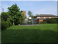
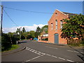
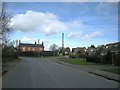
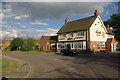
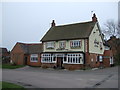
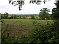
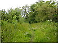
Photos of Barby


Area Information
Living in Barby offers a compact, well-defined community within a built-up area of 41.6 hectares in England. The area’s character is shaped by its mature population, with a median age of 70, suggesting a settled demographic. Home ownership is high at 86%, indicating a stable housing market. Daily life in Barby is supported by nearby amenities, including retail outlets like Co-op Rugby, Sainsburys Rugby, and the Heart of England Co-operative Co, which provide practical conveniences for residents. The area is well-connected via rail, with Rugby and Long Buckby Railway Stations offering access to broader networks. For families, the Barby Church of England Primary School is a local fixture, though no secondary schools are listed. Digital connectivity is strong, with a broadband score of 99 and mobile coverage of 84, ensuring reliable internet for both work and leisure. Barby’s compact size and proximity to services make it a practical choice for those seeking a balanced lifestyle without the need for long commutes.
- Area Type
- Built Up Area 250
- Area Size
- 41.6 hectares
- Population
- Not available
- Population Density
- Not available
Residents of Barby have access to a range of nearby amenities that support a practical lifestyle. Retail options include Co-op Rugby, the Heart of England Co-operative Co, and Sainsburys Rugby, providing essential shopping and grocery needs within easy reach. The presence of two railway stations—Rugby and Long Buckby—offers convenient access to public transport, whether for commuting, visiting nearby towns, or exploring further afield. While the data does not mention parks or leisure facilities, the compact size of Barby implies that local amenities are likely to be within walking or short driving distance. The combination of retail outlets and rail links ensures that daily life in Barby is efficient, with minimal need for long trips. This mix of convenience and connectivity makes the area suitable for those prioritising practicality and accessibility.
Amenities
Schools
The nearest school to Barby is the Barby Church of England Primary School, which serves the area’s younger residents. As a primary school, it caters to children aged 4 to 11, though no secondary schools are listed in the data. The presence of a single primary school suggests that families may need to consider additional options for secondary education, such as commuting to nearby towns. The school’s role in the community is likely significant, providing a focal point for local families. However, without further details on its Ofsted rating or performance, it is difficult to assess its quality. For parents, the availability of a primary school within the area is a practical advantage, though the absence of secondary schools may require careful planning for older children’s education.
| Rank | School | Type | Entry gender | Ages |
|---|
Explore more schools in this area
Go to Schools tabDemographics
Barby’s population is predominantly older, with a median age of 70, reflecting a community that may be more retired or long-established. Home ownership is exceptionally high at 86%, suggesting a strong preference for owning property over renting. While specific data on household composition and accommodation types is not provided, the overall demographic profile indicates a stable, low-turnover population. The area’s age profile may influence local services and amenities, with a focus on accessibility and convenience for older residents. There is no explicit data on ethnic diversity or religious composition, but the absence of such details does not imply homogeneity—only that the data is not available. The high home ownership rate and mature age profile suggest a community with long-term residency patterns, which can contribute to a cohesive, familiar neighbourhood environment.
Household Size
Accommodation Type
Tenure
Ethnic Group
Religion
Household Composition
Age
Household Deprivation
NS-SEC
Explore more demographic insights in this area
Go to Demographics tabPlanning
Planning Constraints
- Crime RiskPremium