Area Overview for Bancroft Ward
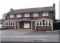
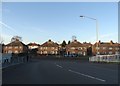
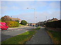
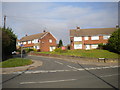
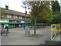
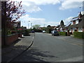
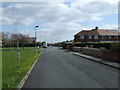
Photos of Bancroft Ward
Area Information
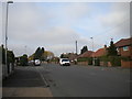
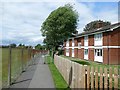
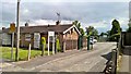
Bancroft Ward is a district borough unitary ward covering 67.5 hectares in England. Living in Bancroft Ward offers residents a defined space with specific constraints and clear safety profiles. The area is characterised by a high fixed broadband quality score of 95, ensuring reliable digital connectivity for everyone. You will find that the ward passes assessments for flood risk, Ramsar wetland sites, areas of outstanding natural beauty, protected nature reserves, and protected woodland. These results indicate a low flood risk coverage and no specific planning constraints related to protected natural areas. Consequently, building and development potential faces minimal environmental hurdles. However, the safety profile requires attention. The crime risk assessment carries a warning level with a score of 35 out of 100. This medium crime risk means standard security precautions are advisable for all residents of Bancroft Ward. While the area avoids major environmental protections or flood vulnerabilities, the higher crime score distinguishes it from areas with lower risk figures. Houses in Bancroft Ward sit in a context where you must weigh excellent internet infrastructure against the need for vigilant personal security measures. This location presents a straightforward choice for those prioritising digital reliability while accepting average safety standards.
- Area Type
- District Borough Unitary Ward
- Area Size
- 67.5 hectares
- Population
- Not available
- Population Density
- Not available
Demographics
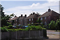
The community within Bancroft Ward has a distinct age profile, with a median age of 70. Comparing this figure to the national average of 40 years reveals a significant demographic shift. Most people living in this ward fall into older age categories, making Bancroft Ward a retirement-oriented or mature neighbourhood. You are likely to encounter a quieter environment where the population is stabilised rather than growing rapidly. This age structure influences local services and the general pace of daily life for those residing here. Homeownership plays a central role in the community composition. In Bancroft Ward, 46% of people own their homes outright or with a mortgage, leaving the remaining percentage renting or living with family. This home ownership rate is slightly below the typical 65% found in many established suburbs, suggesting a different property tenure mix than you might expect in similar regions. Household data reflects a total composition suitable for an older demographic, though specific breakdowns by family type are not available. The area shows varying levels of deprivation and diversity, though specific statistics on these fronts are not provided in the available data. Religion and predominant ethnic group figures are also not currently accessible. Regardless of these missing details, the age and ownership data define the primary character of the ward. Living in Bancroft Ward means settling into an area where senior citizens and fixed-term residents form the core of the population, with a moderate proportion of homeowners.
Household Size
Accommodation Type
Tenure
Ethnic Group
Religion
Household Composition
Age
Household Deprivation
NS-SEC
Explore more demographic insights in this area
Go to Demographics tabPlanning
Planning Constraints
- Flood RiskPremium
- Ramsar Wetland SitesPremium
- Area of Outstanding Natural BeautyPremium
- Protected Nature ReservePremium
- Protected WoodlandPremium
- Crime RiskPremium