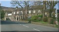
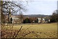
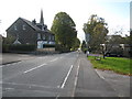
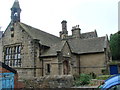
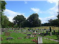
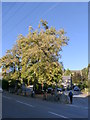
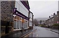
Area Overview for Bamford
Photos of Bamford

Area Information
Living in Bamford offers a distinct experience within the Derbyshire landscape. This built-up area spans 55.7 hectares, creating a compact, established community rather than a sprawling city. The character of Bamford is defined by its density as a town or city, providing residents with a sense of closeness that is often missing in wider rural counties. You will find a neighbourhood where daily life revolves around specific, named localities like Hope and Hathersage, which are integrated into the wider transport network. The area does not boast the vast institutions or diverse economies of major metropolitan hubs. Instead, Bamford functions as a contained, cohesive entity where boundaries are clear and the community structure is intimate. This concentration means you have immediate access to essential services without needing to travel far from your doorstep. The area's size ensures that every street and plot contributes to the overall footprint of the settlement, reinforcing a shared identity among residents. When considering homes in Bamford, you are entering a defined space where the urban and rural elements blend tightly. This setup suits those who prefer a focused living environment over the dispersed nature of larger counties. The distinctness of Bamford lies in its self-contained quality and the лёгкость of moving between local amenities without navigating complex commuter routes.
- Area Type
- Built Up Area 250
- Area Size
- 55.7 hectares
- Population
- Not available
- Population Density
- Not available
Your daily life in Bamford is serviced by a compact cluster of retail and transport amenities within easy reach. The nearest retail options include Spar, Co-op Bradwell, and another Spar, offering basic provisions and essentials without the need for a journey to a town centre. The standard of shopping remains focused on convenience rather than specialist boutiques or large supermarkets. Five railway stations are situated nearby, specifically Bamford Railway Station, Hope Railway Station, and Hathersage Railway Station, providing clear links for travel outside the local boundary. These stations facilitate easy access to bigger cities while keeping you grounded in the community. The lifestyle is defined by this accessibility to essential services and the quietness of a small, defined neighbourhood. You do not have access to a wide variety of leisure outlets or fine dining establishments listed in the immediate data. Instead, the charm lies in the proximity to essential services like Spar and the railway links. The area supports a self-sufficient routine where you rarely need to venture far for groceries or tickets. This setup suits those who value tranquility and do not require the vibrancy of a high-density urban centre.
Amenities
Schools
Families with school-age children in Bamford have access to a single local educational institution. Bamford Primary School stands as the only primary school listed within the area. It holds an Ofsted rating of 'good', providing a reassuring standard of education for young learners. The absence of secondary schools in the immediate vicinity means that older pupils must look beyond these borders for further education. This situation is typical for small towns where the population density does not support large comprehensive colleges. Homes in Bamford are often attractive to locals who intend to raise children, although the median age of 70 suggests few residents currently fall into this parenting bracket. The presence of a school rated 'good' ensures that prospective owners are not reliant on distant provision for early years. For families moving to the area, the distance to secondary institutions is a factor to weigh against the benefits of living in this compact borough. The single-school model simplifies the selection process but limits local options for specialisms or alternative curriculums. You must factor in transport logistics to move children to secondary facilities once they progress beyond primary level.
| Rank | School | Type | Entry gender | Ages |
|---|
Explore more schools in this area
Go to Schools tabDemographics
The community in Bamford reflects a significant demographic shift towards later life. With a median age of 70, the population skews heavily towards elderly residents compared to the national average. The most common age bracket spans adulthood in general terms but is dominated by those in their later years. This age profile suggests a neighbourhood where retirement and leisure take precedence over career-based urban migration. Home ownership stands at a formidable 74%, indicating that the majority of households are primary residents rather than tenants. This high ownership rate points to a stable, long-term settlement where families and individuals have established roots for decades. The accommodation types largely support this ownership model, though specific breakdowns of terraced housing versus semi-detached homes are not detailed in current records. The lack of young families or recent graduates means the social dynamic relies heavily on established networks. Deprivation levels and specific ethnic or religious compositions are not recorded in the available figures, which keeps the public profile focused on age and tenure. You can expect a quieter environment where life pace is determined more by availability of leisure time than by professional demands. Living in Bamford means joining a society where the primary economic activity is likely pensions or savings rather than daily wage labour.