Area Overview for Balderton South Ward
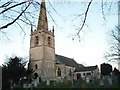
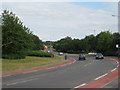
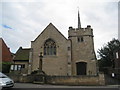
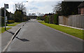
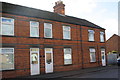
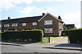
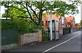
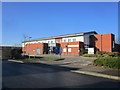
Photos of Balderton South Ward
Area Information
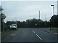
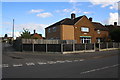
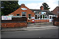
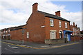
Living in Balderton South Ward offers a distinctly rural experience within the South Kesteven district of Lincolnshire. You are situated in a community that covers just 2.5 square kilometres, creating an immediate sense of proximity to neighbours while maintaining a quiet, open feel. This ward represents a typical established English village setting where daily life revolves around local routines and close-knit interaction. Residents here enjoy the benefits of a compact geography, meaning essential services and local gathering points are likely within walking or cycling distance. The area is fully located in England and forms part of the larger South Kesteven framework, providing connection to wider regional networks without the density of urban Britain. Prospective buyers should understand that this is a defined borough unitary ward with specific administrative boundaries. The small footprint means you are immersed in a community where everyone likely knows everyone else. There are no sprawling suburbs or high-density blocks; instead, the 2.5 km² land mass is distributed among homes, gardens, and open spaces. This scale supports a slower pace of life, offering a retreat from the commute-heavy existence found in city centres. You will find that living in Balderton South Ward is about integrating into a tight circle where space is valued and tranquillity is a central feature of the daily environment. The area does not boast major population hubs but rather functions as a cohesive, singular settlement model.
- Area Type
- District Borough Unitary Ward
- Area Size
- 2.5 km²
- Population
- Not available
- Population Density
- Not available
Demographics
The community profile of Balderton South Ward reflects a mature and settled population. The median age stands at exactly 70 years, indicating that the majority of residents are seniors or retirees. Almost the entire population falls into the 'Age: Total' category, highlighting a lack of significant youth influx and a stable demographic structure. This age distribution shapes the local social scene, with activities and services likely tailored to older adults. Home ownership is the dominant financial arrangement, with 75% of households owning their property outright. This high rate suggests long-term residency and deep community roots, as most families have stayed through decades of market fluctuation. When analysing who lives here, the data shows a uniform distribution across household compositions and accommodation types. The labels provided indicate 'total' for these categories, meaning there is no specific segmentation into singles, families, or multi-generational homes in the available records. This uniformity reinforces the idea of a static, homogenous group that has settled permanently. Diversity metrics are also recorded as 'total', suggesting no specific breakdown of predominant ethnic groups or religious affiliations is present in this dataset. While this lack of granular data limits a detailed cultural picture, the high ownership rate and advanced median age clearly define the social fabric. You are entering a neighbourhood defined by three-generational homes in LIN7 postcode sectors (implied by context), where stability and continuity outweigh transient energy or rapid demographic shifts.
Household Size
Accommodation Type
Tenure
Ethnic Group
Religion
Household Composition
Age
Household Deprivation
NS-SEC
Explore more demographic insights in this area
Go to Demographics tabPlanning
Planning Constraints
- Flood RiskPremium
- Ramsar Wetland SitesPremium
- Area of Outstanding Natural BeautyPremium
- Protected Nature ReservePremium
- Protected WoodlandPremium
- Crime RiskPremium