Area Overview for Awsworth, Cossall & Trowell Ward
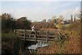
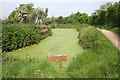
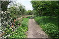
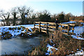
Photos of Awsworth, Cossall & Trowell Ward

Area Information
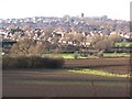
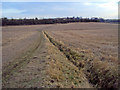
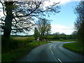
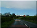
Awsworth, Cossall & Trowell Ward is a distinct district borough unitary ward situated in England. This small ward covers an area of 15.1 km², creating a compact community that is easy to navigate. The location is defined by its residential character and established boundaries rather than rapid urban expansion. Living in Awsworth, Cossall & Trowell Ward means you are part of a tightly knit locality where daily life revolves around local amenities and familiar surroundings. The ward does not fall within an Area of Outstanding Natural Beauty, nor does it contain Ramsar wetland sites, meaning there are fewer restrictive planning constraints than in some other rural areas. However, the presence of protected woodland does add a layer of environmental consideration to the local landscape. The scale of the ward suggests a low density of development within this specific geographical boundary. Prospective homebuyers will find the physical footprint of the area manageable for those seeking a quiet but accessible community. The ward functions as a self-contained entity within the broader borough structure, offering a specific slice of suburban life in England.
- Area Type
- District Borough Unitary Ward
- Area Size
- 15.1 km²
- Population
- Not available
- Population Density
- Not available
Demographics
The community in Awsworth, Cossall & Trowell Ward reflects a mature population with a median age of 70 years. This demographic profile indicates a stronghold of older residents who have likely lived in the area for many decades. Almost all household compositions and accommodation types present in the data are aggregated under totals, suggesting a uniformity in how people structure their living arrangements compared to more mixed-age districts. With 83% of residents owning their homes, the ward is firmly established as an owner-occupied community. This high level of tenure implies that many families have deep roots in the locality. Such ownership rates often correlate with long-term stability but may mean fewer first-time buyers compared to high-rental zones. The predominant ethnic group and religious affiliations are recorded as totals, reflecting the general composition of the wider population within this specific ward. The lack of a younger median age suggests limited inflow of families with children seeking new schools. When considering homes in Awsworth, Cossall & Trowell Ward, you are entering a neighbourhood defined by senior residents and legacy homeowners rather than transient tenants or young professionals.
Household Size
Accommodation Type
Tenure
Ethnic Group
Religion
Household Composition
Age
Household Deprivation
NS-SEC
Explore more demographic insights in this area
Go to Demographics tabPlanning
Planning Constraints
- Flood RiskPremium
- Ramsar Wetland SitesPremium
- Area of Outstanding Natural BeautyPremium
- Protected Nature ReservePremium
- Protected WoodlandPremium
- Crime RiskPremium