Area Overview for Aston upon Trent
Photos of Aston upon Trent


Area Information
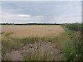
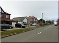
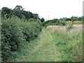
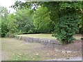
Living in Aston upon Trent offers a distinct experience defined by its small-scale character and rural setting. This civil parish covers an area of 8.0 km², which translates to a relatively compact community footprint compared to larger towns. You will find yourself in a space where proximity to nature is immediate, yet daily necessities remain accessible within a localised radius. The area functions as a peaceful retreat where the pace of life shifts away from urban density. Daily life here centres on quiet neighbourhood streets and a strong sense of place that defines living in Aston upon Trent. Prospective buyers often appreciate the minimalist environmental constraints, such as the absence of Ramsar sites or Areas of Outstanding Natural Beauty, which means planning restrictions may differ from more protected rural zones. However, the compact size means that noise or activity from neighbours can feel more immediate than in larger developments. Homes in Aston upon Trent suit those seeking a low-key environment rather than a bustling high street experience. The character of the parish is shaped by its history as a small administrative unit, providing a consistent backdrop for residents who value stability. You are purchasing into an established area where the boundaries have remained clear and the community identity has stayed intact over time.
- Area Type
- Parish
- Area Size
- 8.0 km²
- Population
- Not available
- Population Density
- Not available
Demographics
The community in Aston upon Trent presents a clear demographic profile that separates it from many growing metropolitan areas. You will encounter a resident population with a median age of 70, indicating a community dominated by older adults. This age structure suggests that the local atmosphere is quiet and established, характерный for areas popular with retirees. Household composition data confirms this trend, showing that the total household make-up aligns with the senior demographic. Home ownership stands at 85%, a figure that underscores the area's status as a settled, long-term community rather than a transient rental market. This high rate of ownership implies that most residents have deep roots in Aston upon Trent and prioritise stability. Accommodation type data reflects a stock suited to these demographics, likely featuring houses adapted for older living rather than high-density flats. While specific ethnic and religious breakdowns are not detailed in the current records, the homogeneity of an older, owner-occupied population often correlates with less diversity in recent migration data. The social fabric here is built on long-standing connections. For younger homebuyers, this means entering a mature market where school communities may be smaller. The lack of young families is evident in the age profile, suggesting limited presence of schools near Aston upon Trent within the immediate parish boundaries.
Household Size
Accommodation Type
Tenure
Ethnic Group
Religion
Household Composition
Age
Household Deprivation
NS-SEC
Explore more demographic insights in this area
Go to Demographics tabPlanning
Planning Constraints
- Flood RiskPremium
- Ramsar Wetland SitesPremium
- Area of Outstanding Natural BeautyPremium
- Protected Nature ReservePremium
- Protected WoodlandPremium
- Crime RiskPremium